A new feature of Civil Site Design V26 is the Best Fit Alignment command. This command is available to AutoCAD and BricsCAD users and allows you to create an alignment based on Cogo Point or polyline data.
When the command is run, the Best Fit algorithm analyses the Cogo Points in the specified Point Group or the vertices of the selected Polyline and fits a series of tangents and curves to create a new Alignment that describes these inputs. The user is able to change the radii, curve detection and tolerance of the algorithm to refine the fit to the original data.
How it Works
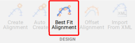
This command allows you to build a Best Fit Alignment using Cogo points or existing polylines. The command is available from the ribbon:
Alignments >> Design >> Best Fit Alignment
Before generating a Best Fit Alignment from Cogo points, create a point group of the points to use for the alignment creation.
Click here (https://www.help.civilsurveysolutions.com/CSD/HelpSystem/CSD_for_Civil_3D/index.htm#t=Commands%2FPointGroups%2FPointGroups.htm&rhsearch=point%20group&rhhlterm=point%20points%20groups%20group ) to learn more about point groups.
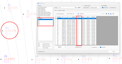
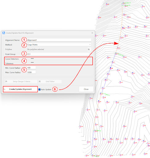
Once the Point Group for the alignment has been defined, run the Best Fit Alignment command and complete the follow:
- Give the alignment a name.
- Choose the Best Fit method: Cogo Points or Polyline.
- Choose the desired Point Group or Polyline.
- Slide the bars left and right to adjust the curve detection and tolerance of the Best Fit algorithm until the optimal fit is achieved.
- Change the minimum and maximum curve radii as needed.
- Select Create/Update Alignment.
Once the Best Fit Alignment has been created, use the Edit Alignment command for further modifications.
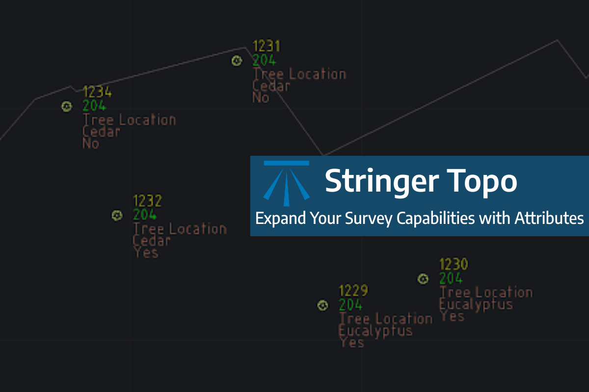
Field attributes provide Surveyors with the ability to include additional data in their Survey pickup of points. With Stringer Topo V26 users can now include additional data (attribute data) with their COGO points and survey strings for review, editing and output from their drawing. There are a number of ways to add attributes to your […]
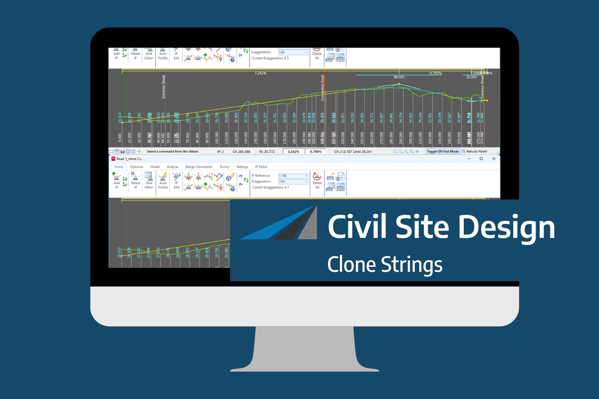
In the Civil Site Design v26 release for AutoCAD and BricsCAD, a new Clone String command has been added. This command allows users to create a clone of an existing string as a profile string including the alignment and vertical profile. This command turns what was a multi-step process into a one step process. You […]

Civil Site Design/Corridor EZ v26 delivers a major upgrade to its Custom Variations functionality with the introduction of Standard Kerb Transitions. Since v25, Custom Variations have been a core feature of Civil Site Design/Corridor EZ, allowing users to apply conditional logic and geometry overrides to cross sections at specified chainages. With v26, this functionality is […]
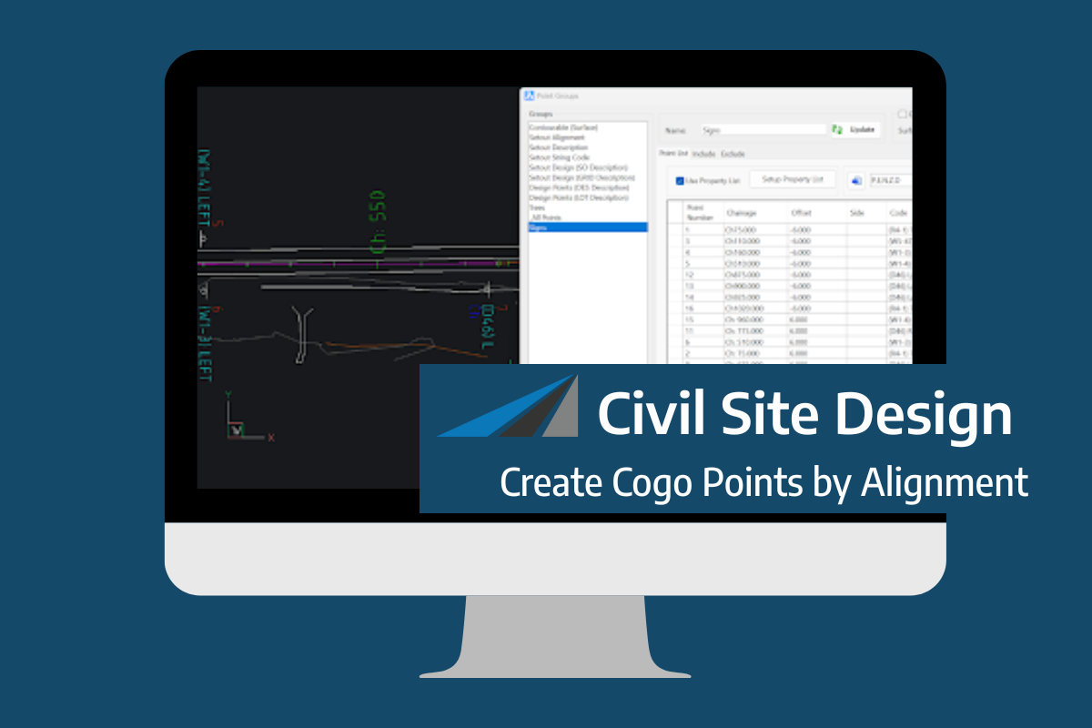
Civil Site Design V26 introduces the new command Import Cogo Point File (by Alignment). This tool allows you to import a file that specifies chainage and offset along an alignment for points to be created. The command is available for Civil Site Design and Stringer across all base platforms. The command can be found at […]