Sectional Volumes | Introduction

- Live Subgrade View: When you select a chainage on a string, the tool presents a live view of the subgrade template applied to that specific string. Additionally, polygons representing the different areas of cut and fill are displayed.
- Visualisation Tools: The settings tab provides options to toggle the display of subgrade polygons and separate polygons, allowing for clearer visualisation of cut and fill areas.
- Automatic Intersection Trimming: The software automatically trims out the intersection on any road string. This means that the volume calculations are not affected by the subgrade for the kerb/curb return replacing the road subgrade in the intersection area.
- Accurate Subgrade Calculation: The tool only calculates the road subgrade where the road actually begins, taking into account the varying positions of kerb/curb tangent points. This ensures accurate volume calculations.
- Stripping Value Application: If a stripping value is applied through the Design Data Form, it is automatically factored into the calculations for all sections.
Sectional Volumes | Multi Section Viewer
A new multisection viewer provides a comprehensive view of all cross-sections for a selected string in a single environment. This viewer offers:
- Easy navigation functionality.
- Export capability as a DWG file.
- Options to customise spacing and visuals for plotting.

Sectional Volumes | Calculation Method
The sectional volumes tool uses the average end area method to determine the volume of cut or fill between two cross-sections.
The method calculates the area of fill or cut at each cross-section. Then, the average area of the two cross-sections is calculated. This average is then multiplied by the distance between the two cross-sections, producing the volume of cut or fill. This process is repeated for each subsequent cross-section along the alignment, with the cumulative volume of cut or fill being tracked throughout.
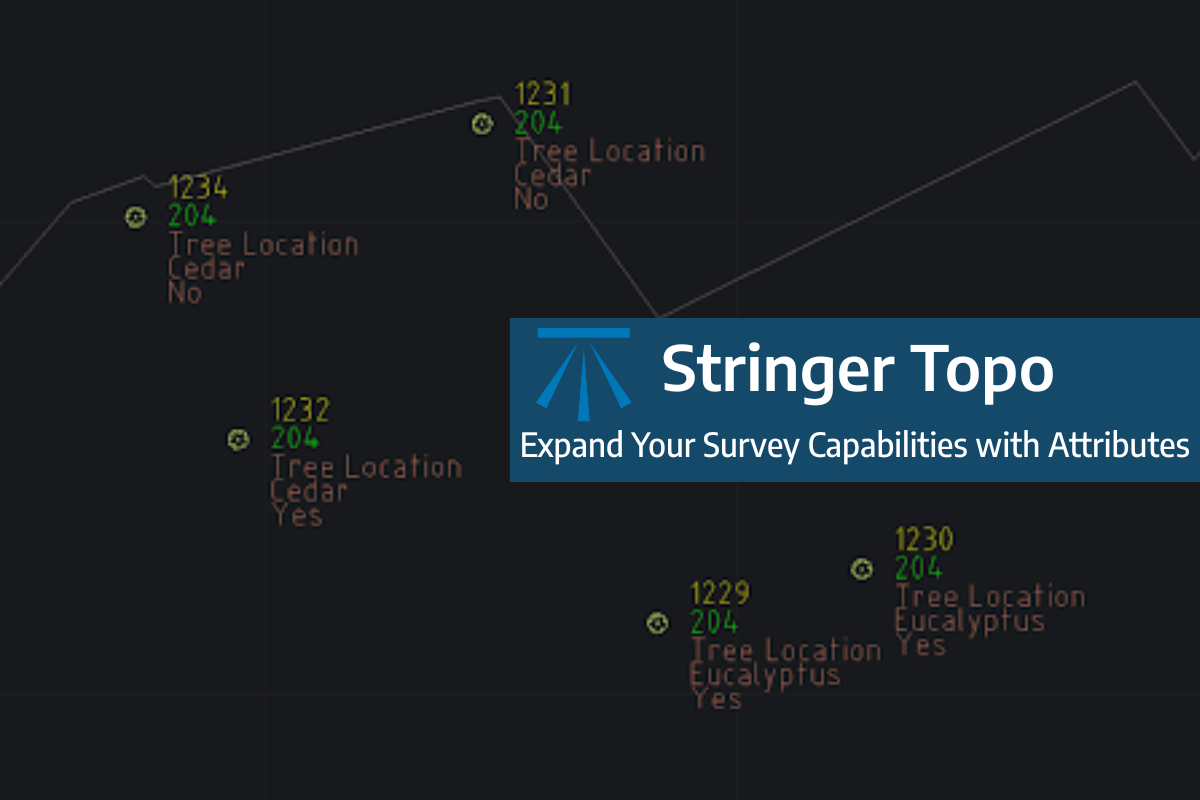
Field attributes provide Surveyors with the ability to include additional data in their Survey pickup of points. With Stringer Topo V26 users can now include additional data (attribute data) with their COGO points and survey strings for review, editing and output from their drawing. There are a number of ways to add attributes to your […]
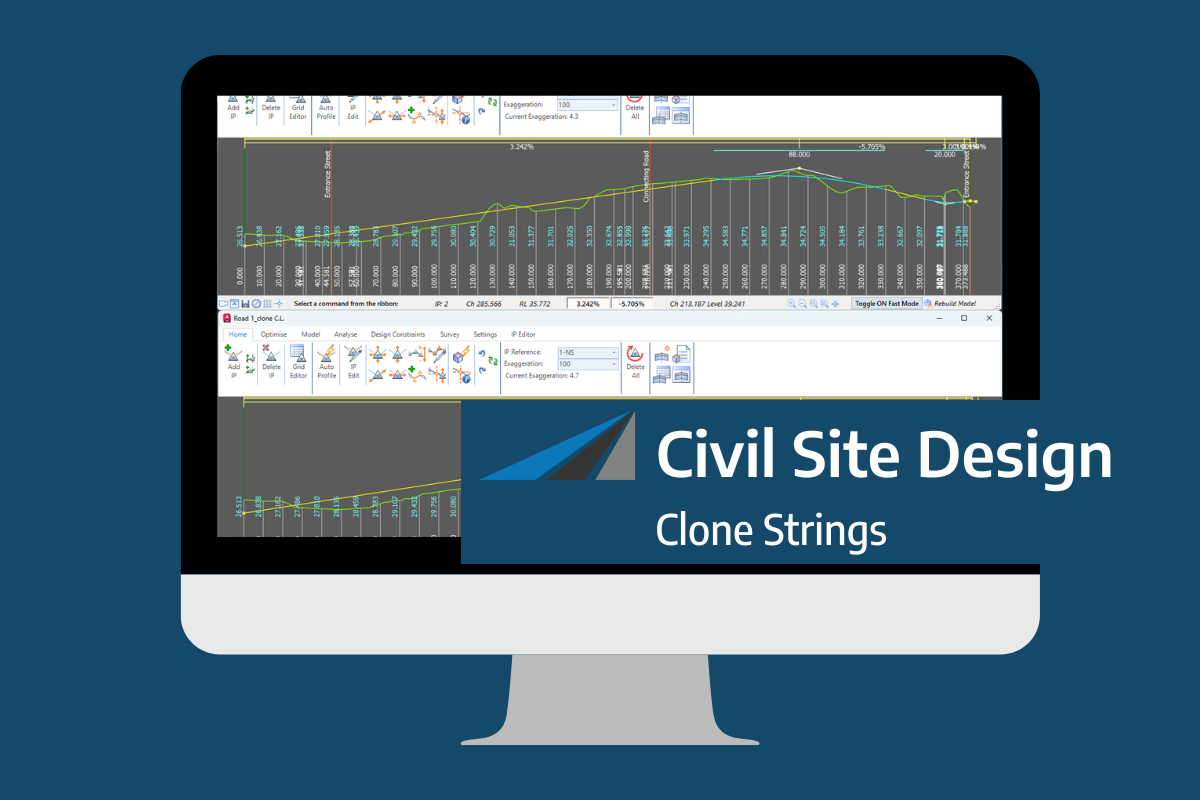
In the Civil Site Design v26 release for AutoCAD and BricsCAD, a new Clone String command has been added. This command allows users to create a clone of an existing string as a profile string including the alignment and vertical profile. This command turns what was a multi-step process into a one step process. You […]

Civil Site Design/Corridor EZ v26 delivers a major upgrade to its Custom Variations functionality with the introduction of Standard Kerb Transitions. Since v25, Custom Variations have been a core feature of Civil Site Design/Corridor EZ, allowing users to apply conditional logic and geometry overrides to cross sections at specified chainages. With v26, this functionality is […]
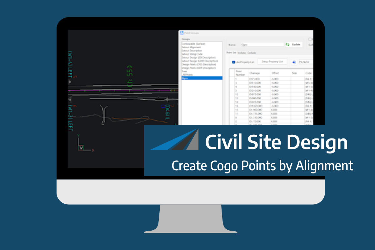
Civil Site Design V26 introduces the new command Import Cogo Point File (by Alignment). This tool allows you to import a file that specifies chainage and offset along an alignment for points to be created. The command is available for Civil Site Design and Stringer across all base platforms. The command can be found at […]