Civil Site Design v27 introduces major advancements across AI-powered workflows, drainage design, interactive model editing, and 3D visualisation. From intelligent project setup to advanced storage analysis, this release is designed to help engineers spend less time configuring tools and more time delivering great outcomes.
Project Assist AI: Context-Aware Support Inside CAD
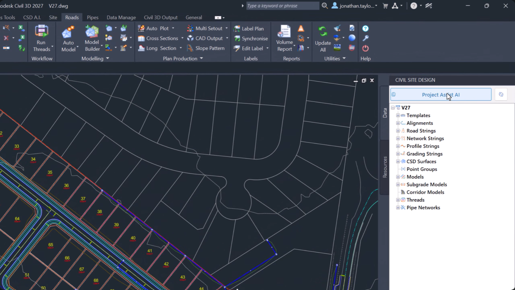
Civil Site Design – Project Assist AI
Project Assist AI brings a new level of intelligence directly into the Civil Site Design environment. By understanding both your project data and design context, it provides instant assistance without leaving your drawing.
Whether you’re looking for technical guidance, reviewing specifications, or generating reports, Project Assist AI helps streamline everyday workflows and reduce time spent searching for information.
Tex: Your Technical Assistant and Reporting Tool
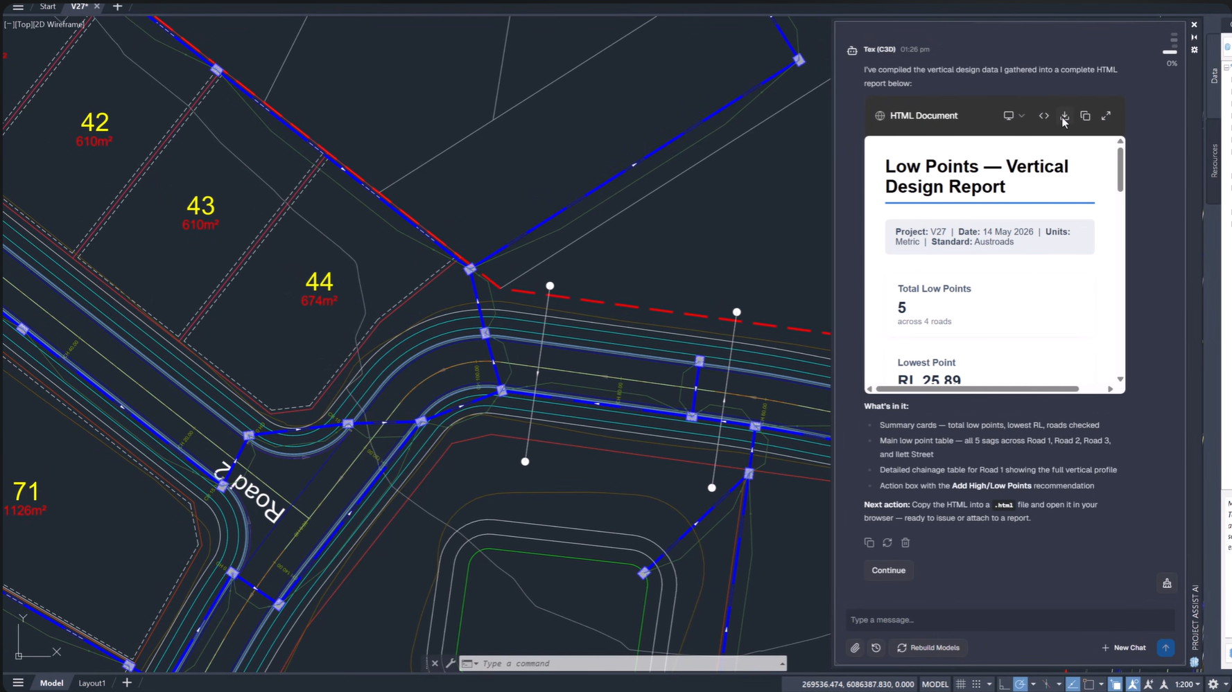
Tex generating reports and analysing drawings
Tex acts as your real-time support and reporting assistant, capable of analysing project data, answering technical questions, and generating detailed reports directly from your design.
By combining access to the Civil Site Design skill library with live drawing inspection, Tex can provide context-aware answers and export HTML reports with minimal effort.
Key Benefits
-
Generate project reports automatically
-
Receive contextual technical support
-
Review specifications instantly
-
Export reports directly from CAD
Intelligent Sections AI: Create Complex Conditional Sections Faster
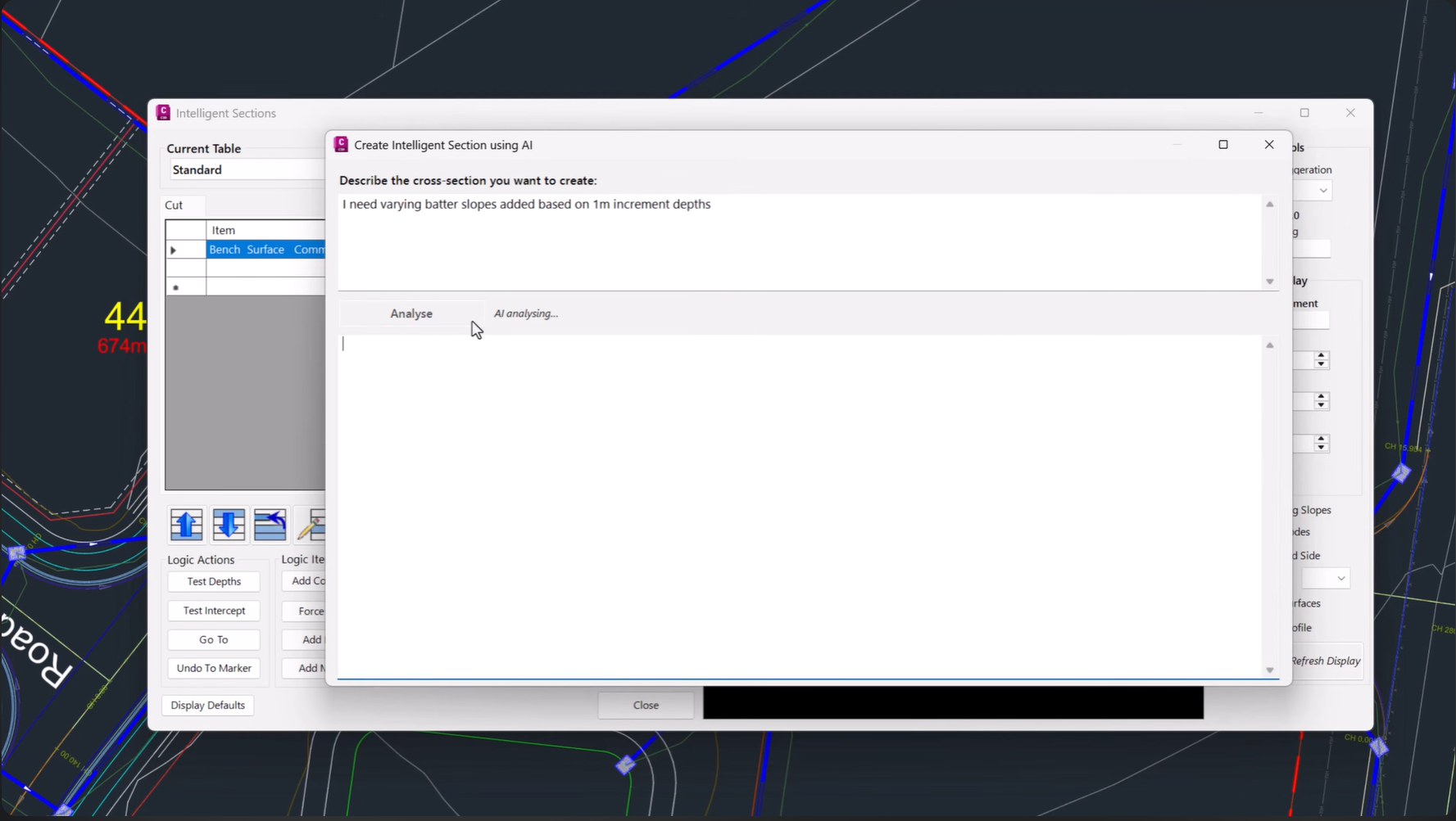
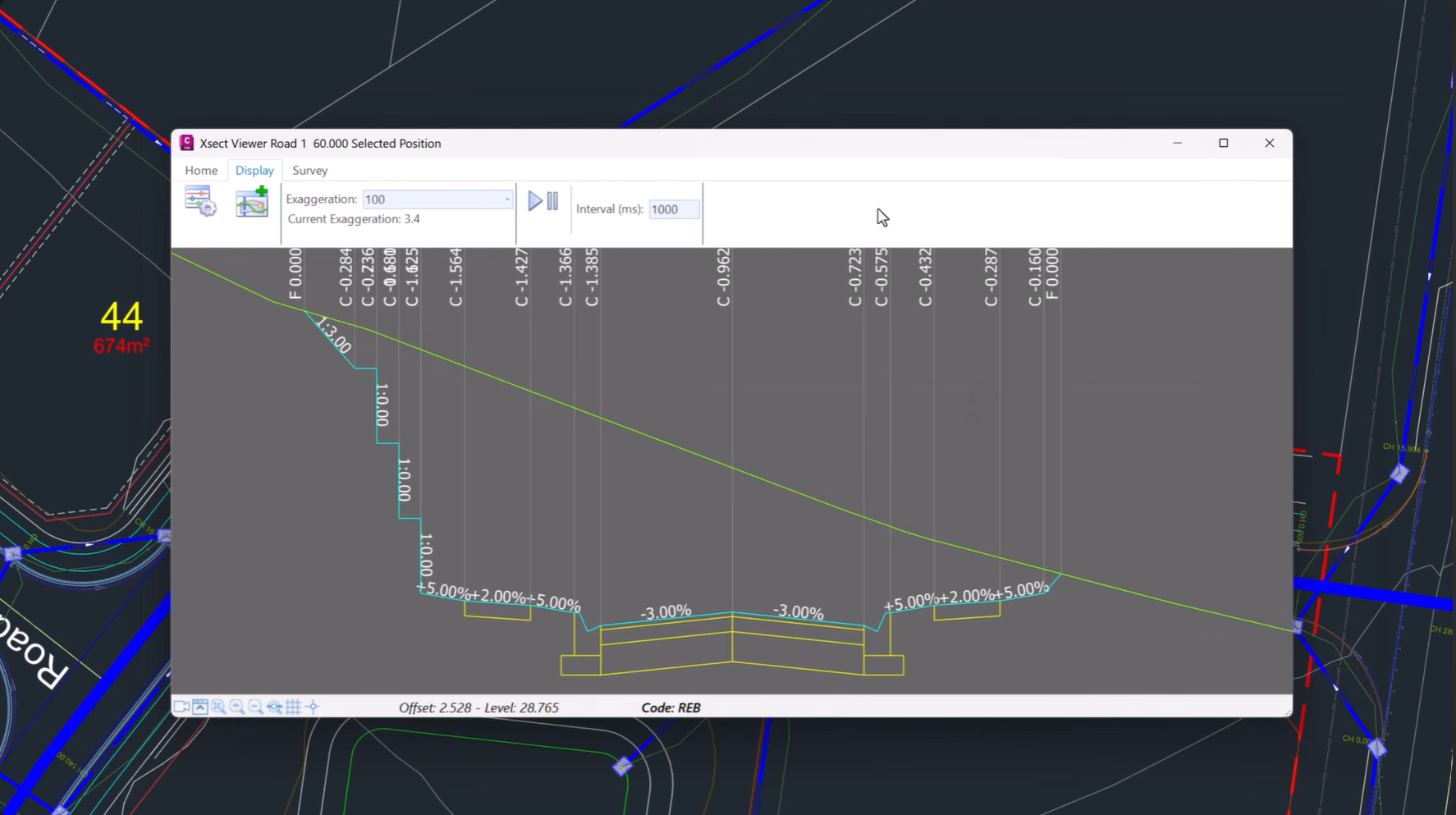
Creating conditional cross sections no longer requires manually building complex decision tables.
Simply describe your desired section in plain language, including features such as table drains, bench batters, and retaining walls, and Intelligent Sections AI automatically generates the underlying logic and decision tables.
This dramatically reduces setup time while maintaining design flexibility.
FastTrack: AI-Powered Project Setup
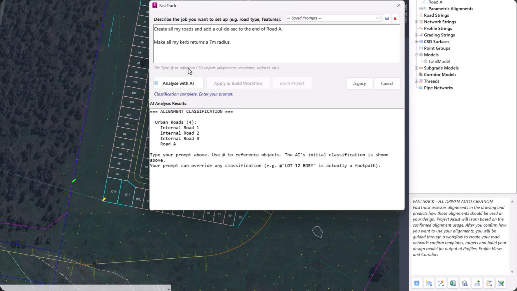
FastTrack Interface
FastTrack, formerly known as Project Assist, helps users move from concept to design faster than ever.
Describe your project at a high level and FastTrack will automatically identify road centrelines, detect curb returns and boundaries, and recommend suitable cross section templates.
FastTrack Automatically:
-
Identifies road centrelines
-
Detects curb returns
-
Recognises project boundaries
-
Suggests cross section templates
Visual Model Editing with Interactive Trim Grips
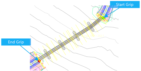
Trim grips being dragged to update extents for a bridge
v27 introduces a more intuitive approach to model trimming.
Instead of manually entering chainages in Model Builder, visual trim grips can now be manipulated directly within the drawing. Simply drag the grips to adjust trim extents instantly.
The result is a faster, more interactive editing workflow with complete control over model limits.
Stage Storage: Advanced Basin Analysis and Visualisation
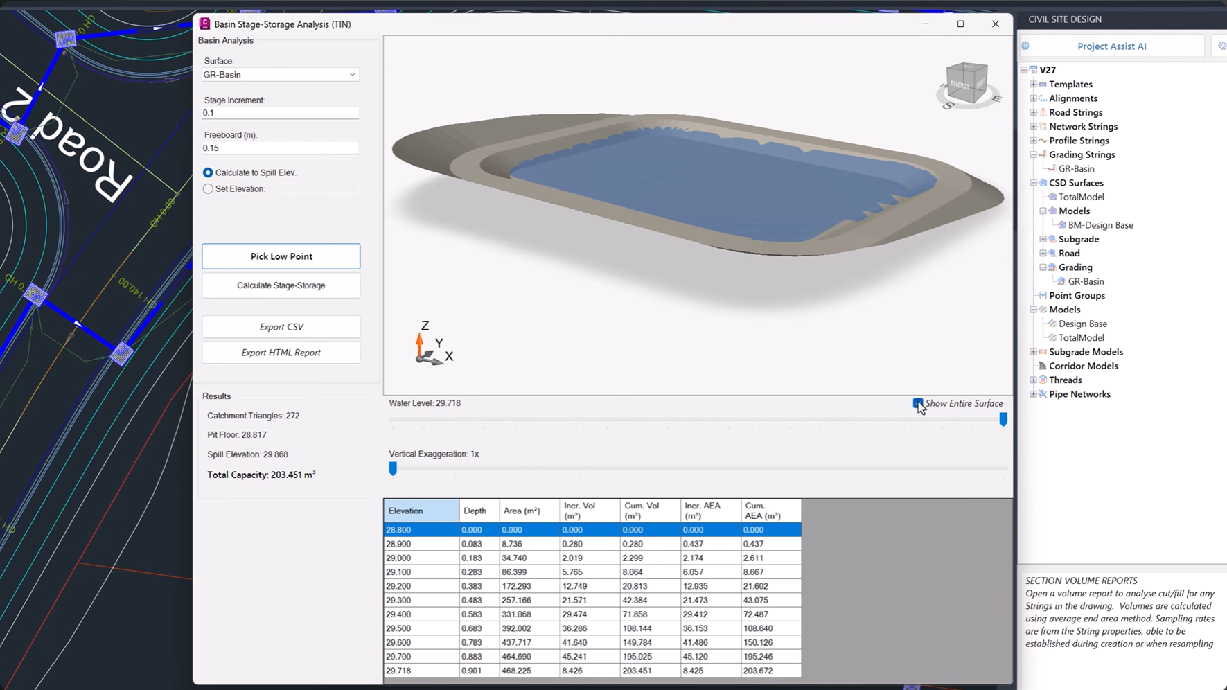
Storage calculations and 3D basin visualisation
The new Stage Storage tool automates basin and depression storage analysis, helping designers quickly evaluate detention basins and wetlands.
Generate stage-storage tables, calculate spill elevations, and review results within an interactive 3D environment that makes understanding storage behaviour easier than ever.
Key Outputs
-
Spill elevations
-
Stage-storage tables
-
Basin capacity analysis
-
Interactive 3D visualisation
Enhanced 3D Visualisation and Sectioning
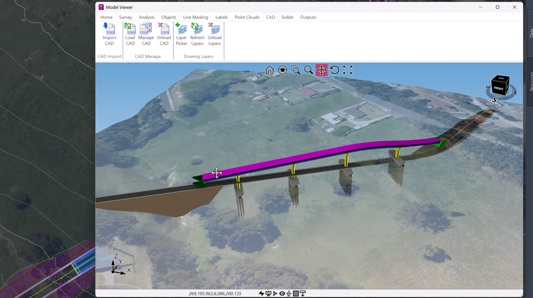
3D Infrastructure Visualisation
Civil Site Design v27 expands support for native CAD 3D geometry, allowing designers to visualise and section:
-
3D polylines
-
Solids
-
Meshes
-
Faces
These elements can now be viewed alongside Civil Site Design models in Model Viewer, Vertical Grading Editor, and Quick Section Tools.
This provides greater project context and more comprehensive design reviews.
Centralised Pipe Network Management
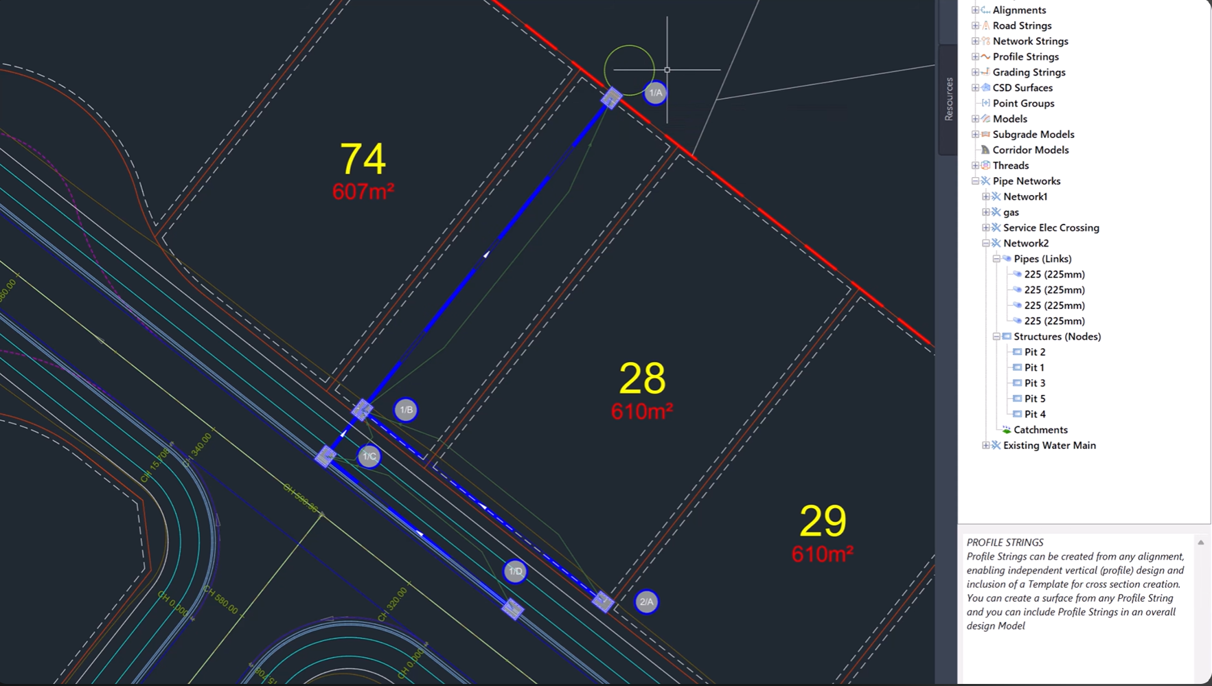
Pipe Network Interface
Pipe networks now have a dedicated home within the Civil Site Design Tool Space.
The new interface provides a structured, hierarchical view of pipes, structures, and catchments, making network management easier and more organised.
Users can also generate long sections and export network data directly from a single location.
Experience the Future of Civil Design
Civil Site Design v27 delivers one of the most significant updates to the platform to date. With AI-powered assistance, automated design workflows, advanced drainage analysis, interactive editing tools, and enhanced 3D visualisation, v27 helps engineers work smarter and deliver projects with greater confidence.
Upgrade today and discover what’s possible with Civil Site Design v27.
Civil Site Design/Corridor EZ V26 introduces support for IFC 4.3 export, giving users a powerful new way to share detailed 3D models with full classification and geometry data. This enhancement allows designers to export corridor models, road elements, and subgrade components as fully structured, BIM-ready files compatible with a wide range of IFC viewers […]
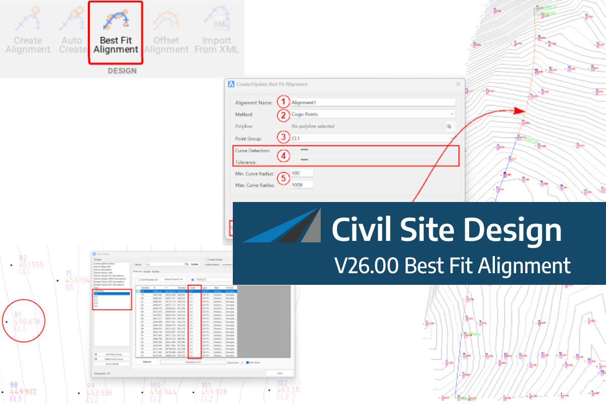
A new feature of Civil Site Design V26 is the Best Fit Alignment command. This command is available to AutoCAD and BricsCAD users and allows you to create an alignment based on Cogo Point or polyline data. When the command is run, the Best Fit algorithm analyses the Cogo Points in the specified Point […]

One of the exciting new features in the Civil Site Design V26 and Stringer Topo V26 release is the Surface from LAS command. Often LiDAR and point cloud data is saved as a LAS file, which previously required interpreting in another software prior to being imported to create a surface. This new command allows you […]
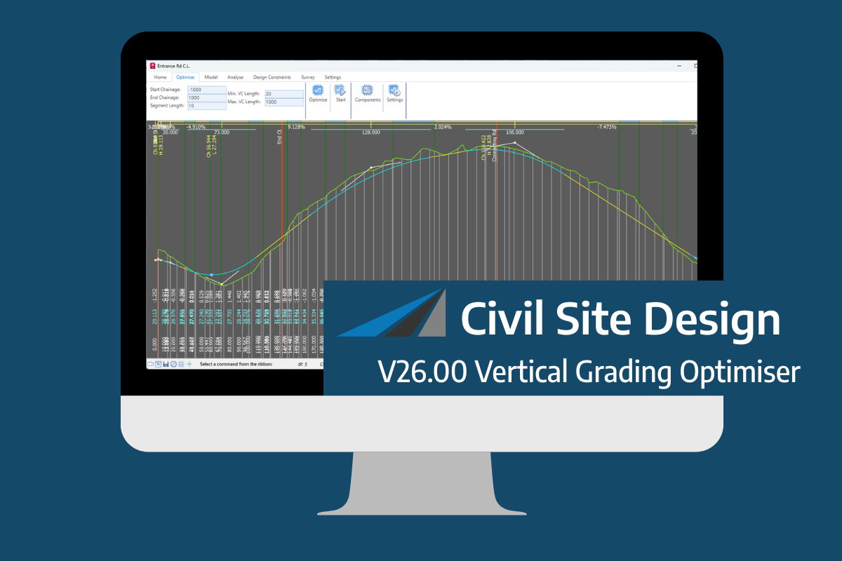
An exciting new tool in Civil Site Design/Corridor EZ v26 is the Vertical Grading Optimizer which can create vertical design profiles based on the parameters you set. Previously, the vertical best fit design profile was based on matching closely to the terrain (within preset cut/fill depths) and adding vertical curves. Mostly, you would remove these […]