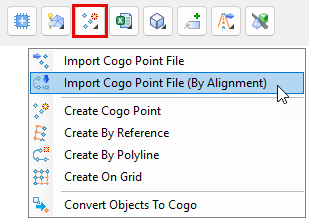
Civil Site Design V26 introduces the new command Import Cogo Point File (by Alignment). This tool allows you to import a file that specifies chainage and offset along an alignment for points to be created. The command is available for Civil Site Design and Stringer across all base platforms.
The command can be found at the bottom of the toolspace under the Cogo Points icon.
The Cogo Points by Alignment command allows you to import coordinated point files containing, at minimum, a chainage and offset input for each point you wish to create. If you are importing data using chainage and offset instead of x,y coordinates, ensure that you have applied (or created) a Point File Format to match the format of the file you are importing.
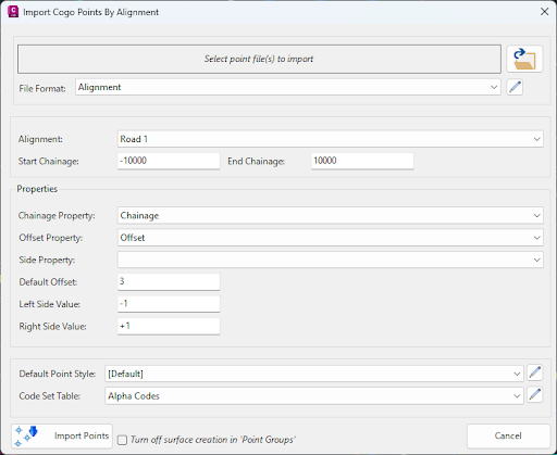
After selecting a file to import and assigning a matching file format are selected, choose the alignment in the drawing that you wish to create the points along, as well as the start and end chainage.
Next, you set properties from the file to match Chainage, Offset and (optionally) Side, so that the software knows which information in the file to apply to create the Points. If you are using positive and negative numbers to differentiate between side for offset, you can leave the Side Property box empty; however, you may have a separate entry in your file to denote ‘side’, which would need to be set as the Side Property.
Lastly, you can set the Default Point Style and Code Set Table to manage the assigned Point Style and layer for each point you will create.
Clicking Import Points will create the points as COGOPoints.
We are pleased to announce the release of Stringer Topo V25.00. This version includes new features and improvements that aim to streamline your surveys within the CAD environment. Stringer Topo V25.00 is available on the following platforms: AutoCAD 2019 to AutoCAD 2025 BricsCAD V22 to BricsCAD V24 Civil 3D 2019 to Civil 3D 2025 Traverse […]

The Stringer Topo V25.00 release will enable access to a Network version. Our adoption of a new Licensing system (QLM) allows us to reintroduce our popular Network version, which has been temporarily unavailable. For Stringer Topo customers who currently have Network licenses on software maintenance, you will be issued new Stringer Topo V25.00 Network license(s) […]

“Civil Site Design: A Year in Review and a Glimpse into the Future,” recording is now available. We have dived into the transformative developments of the past year and shared some plans for the upcoming version V25. This session was led by one of our software developers, Andrew Banson, showcased the major enhancements and new […]

In conjunction with our partners Civil Survey Solutions, we are excited to announce the following upcoming training courses for our products Civil Site Design and Stringer Topo. The courses are delivered by our experts and the training team at Civil Survey Solutions. As an Authorised Autodesk Training Center and Application Developer, you can trust that […]