Since releasing Civil Site Design in the USA in 2007, we have experienced constant growth. A technical distributor, Logis LLC, was appointed in 2015, followed by the establishment of Civil Survey Applications LLC in 2019. Located in Florida, the team of 5 including three civil engineers, is committed to customising the software for the US market and supporting the Autodesk and Bricsys Reseller network who bring the solution to the market.
Key Developments in the USA:
- Customisation for the US Market: Acknowledging that over 90% of civil designers in the US utilise Civil 3D as their primary design tool, we have focused on enhancing corridor functionality to improve road design efficiency. Consequently, a version of Civil Site Design, branded as ‘Corridor EZ’, has been specifically developed for the US market. This version excludes stormwater or sewer functionality and is offered as a single user subscription licence only.
- Corridor EZ on Autodesk Application Store: We are proud to announce that ‘Corridor EZ’ has undergone extensive testing by Autodesk and has been accepted onto the Autodesk Application Store. This is a significant achievement, as most Civil 3D applications on the store are minor utilities, not a major development like ‘Corridor EZ’.
- Success at Autodesk University: Our team recently showcased ‘Corridor EZ’ at Autodesk University to an excellent reception. The stand at peak times attracted a large number of Civil 3D users interested in improving their productivity. With already over 200 civil engineering customers in the US, the prospects for ‘Corridor EZ’ are looking bright!
These highlights along with many others, represent key milestones in the journey of Civil Survey Applications. We continue to evolve, broadening our global reach and enhancing our responsiveness to the unique requirements of civil engineers, designers and surveyors around the world. Our commitment remains focused on innovation, excellence, and customer-centric development, ensuring that our solutions not only meet but exceed the expectations of our diverse user base.
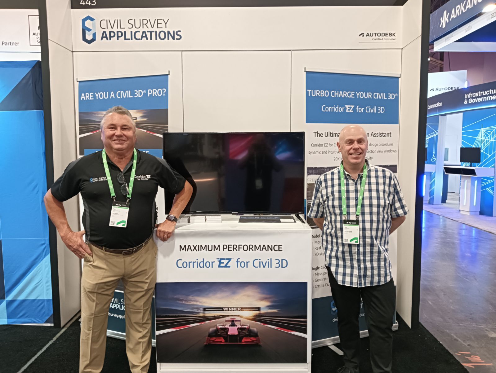
Alex Von Svoboda from Civil Survey Applications LLC and Todd Brewster from Civil Survey Solutions Pty Ltd.
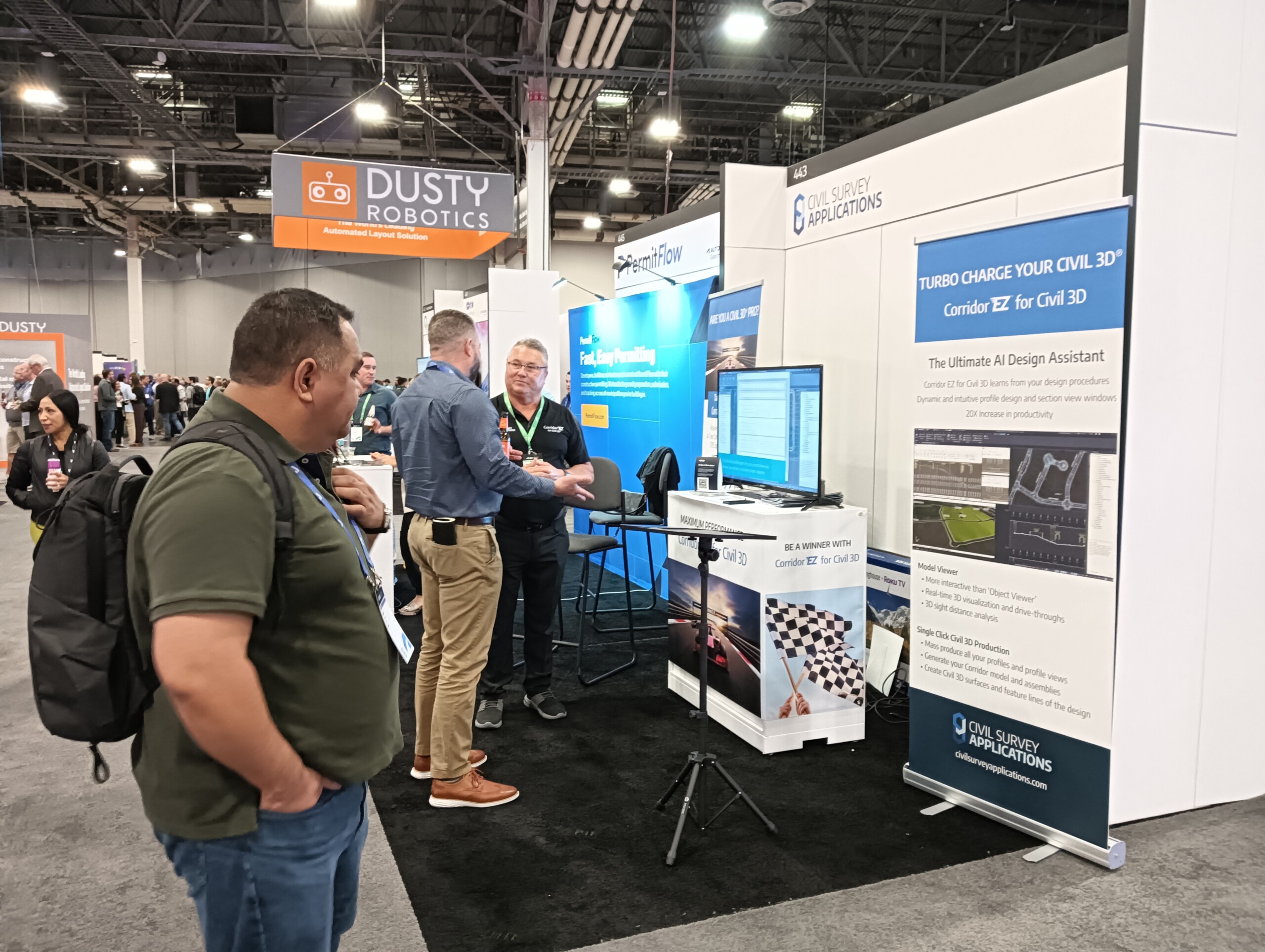
Civil Survey Applications LCC Booth at Autodesk University 2023 – Las Vegas

The latest releases of Civil Site Design V26.10 and Stringer Topo V26.10 are here! These updates focus on addressing customer-reported issues, improving pack mode performance, and introducing new features and efficiency enhancements for working with COGO points and Survey Strings. Civil Site Design V26.10 is available on the following platforms: Civil 3D 2021 to Civil […]

Our streamlined design process shaves hours and days off your Civil 3D projects, including the creation of a Civil 3D Corridor complete with multiple regions, target mapping, and assemblies, at the click of a button. We always aimed to make the corridor like you would, reusing and consolidating similar assemblies wherever possible. So, for the […]

