The DRAINS exchange for Civil Site Design has been established for over 10 years and has provided users with a solution of drafting in the CAD environment, analysing in DRAINS and generating design long sections with the HGL in Civil Site Design. This popular functionality has been a staple for drainage engineers looking to speed up the process of designing and drafting between the applications.
In V18.20, a brand-new interface was created to make it easier for users to transfer pits, pipes, catchments & overflow routes from the project DRAINS for analysis.
In Civil Site Design V23.10 & V24.0, further development was undertaken on the exchange process which provides users with some improved functionality. Here is an overview of some of the updates:
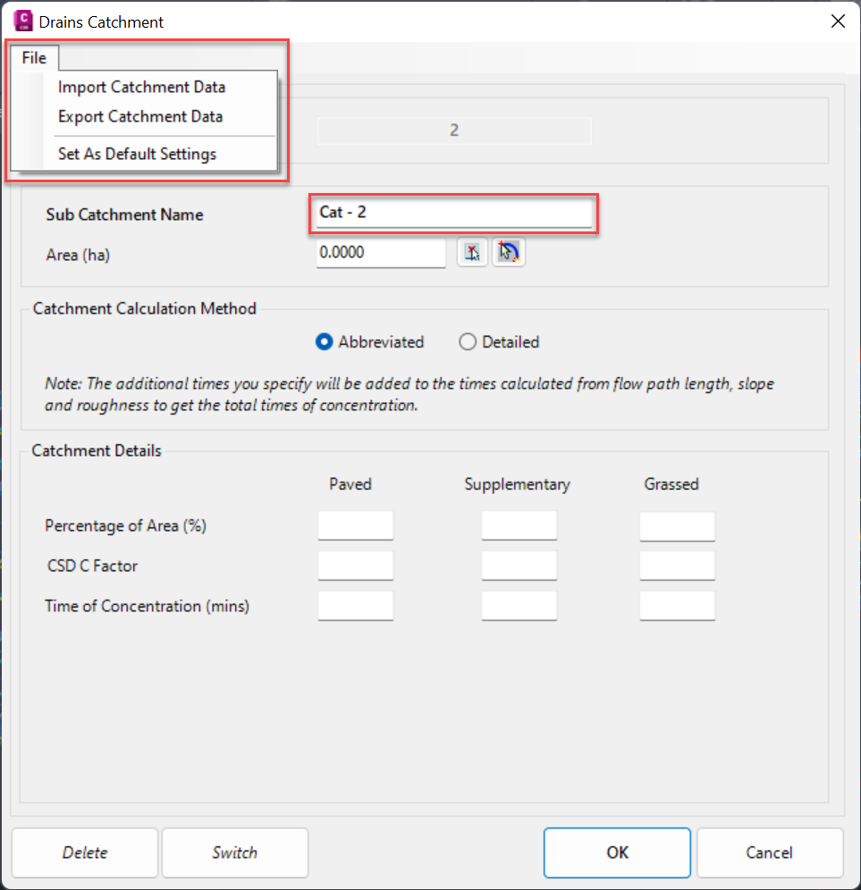
Catchments
The DRAINS Catchment form now has a file menu option to export & import catchment data entries, saving users time in completing the form for every catchment. In addition, the catchment entries can be ‘set as default’, again saving time on form completion. The Sub Catchment Name is automatically named using the pit number assigned from Civil Site Design.
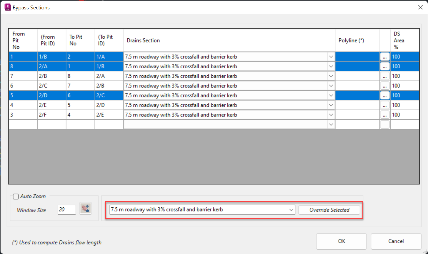
Overflows
The ‘DRAINS section’ column now automatically applies the first DRAINS overflow available in the list, meaning less time manually assigning a DRAINS section to each pit. Quick assignment of ‘DRAINS sections’ can also be applied highlighting multiple rows and overriding selected entries.
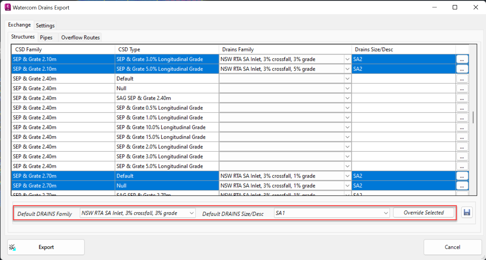
Watercom DRAINS Export
Quick assignment of DRAINS families and size/descriptions can now be applied by highlighting multiple rows and overriding selected entries.
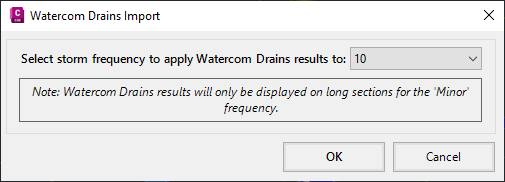
Watercom DRAINS Import
We’ve improved the messaging on DRAINS Import command to confirm that the imported results are displayed for the ‘Minor’ frequency storm.
DRAINS EOFY SALE
Our friends at Watercom are having their best-ever EOFY Sale! Get up to 50% off new DRAINS licences, subscriptions, upgrades, Online Training & and In-Person Workshops!