Released in Civil Site Design V23.10, the Excel Export & Excel Link tools were added to improve the way customers could interact with design elements, outside the software.
Excel Export can export design information from your alignments, strings and models directly to an Excel workbook. This can be useful for reporting and reviewing the design. Excel Link can import a Excel workbook data and assign it back to the design. Where there is a requirement to make bulk edits to cross sections in the Design Data Form, the Excel link can be used to create multiple entries from a single workbook.

In this Driveway Layback playlist we start by demonstrating how, with the application of Design Variations in the Design Data Form, users can use the Linearly Vary function to adjust the kerb template codes, forming a layback shape. This manual process is key to understanding how the Excel Link function is then used to automatically apply the Design Variations in a single command.
We have linked the Excel workbook, referenced in the videos, so users can try this themselves and experiment with the different kerb shape variables and apply the Design Variations to a string. https://downloads.civilsurveysolutions.com/CSD/Documents/Drives.xlsx


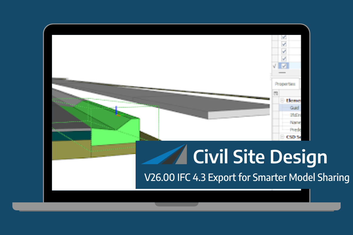
Civil Site Design/Corridor EZ V26 introduces support for IFC 4.3 export, giving users a powerful new way to share detailed 3D models with full classification and geometry data. This enhancement allows designers to export corridor models, road elements, and subgrade components as fully structured, BIM-ready files compatible with a wide range of IFC viewers […]
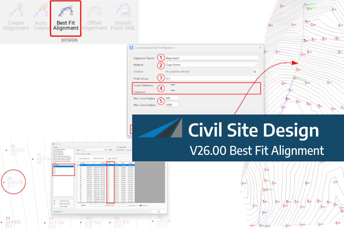
A new feature of Civil Site Design V26 is the Best Fit Alignment command. This command is available to AutoCAD and BricsCAD users and allows you to create an alignment based on Cogo Point or polyline data. When the command is run, the Best Fit algorithm analyses the Cogo Points in the specified Point […]

One of the exciting new features in the Civil Site Design V26 and Stringer Topo V26 release is the Surface from LAS command. Often LiDAR and point cloud data is saved as a LAS file, which previously required interpreting in another software prior to being imported to create a surface. This new command allows you […]
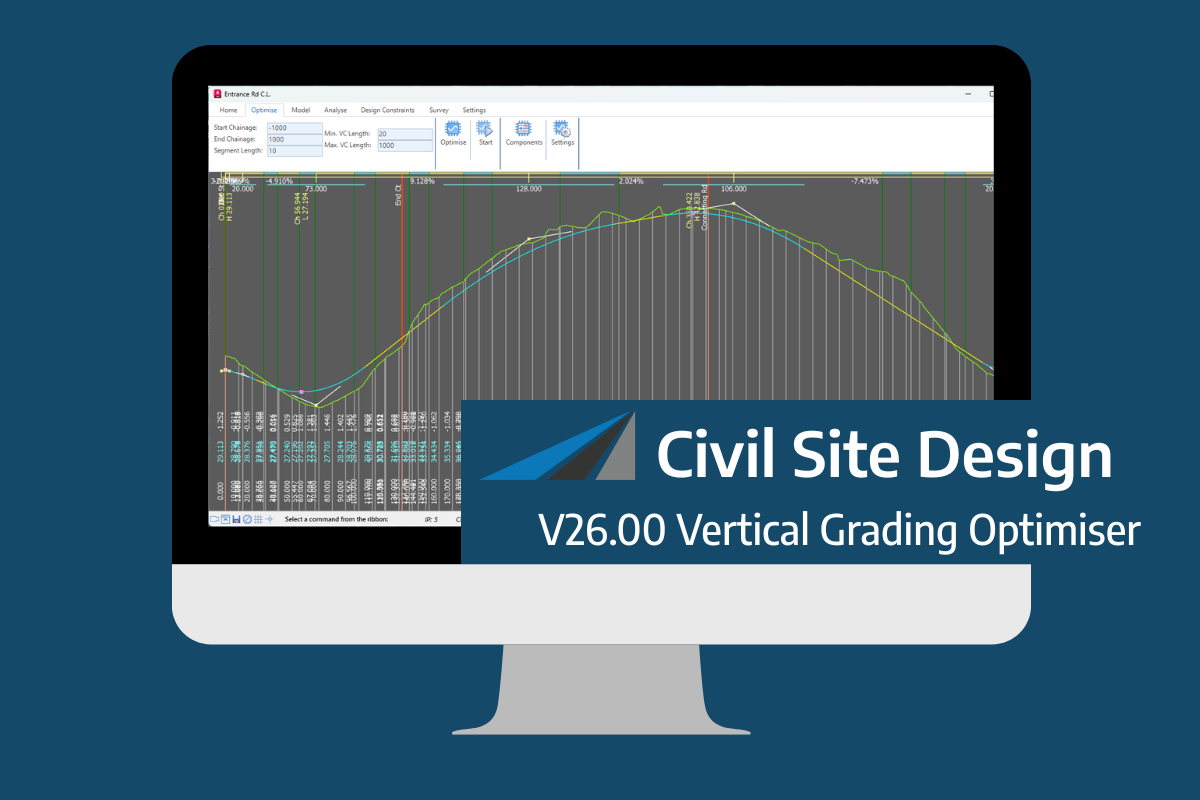
An exciting new tool in Civil Site Design/Corridor EZ v26 is the Vertical Grading Optimizer which can create vertical design profiles based on the parameters you set. Previously, the vertical best fit design profile was based on matching closely to the terrain (within preset cut/fill depths) and adding vertical curves. Mostly, you would remove these […]