Managing drainage networks often involves working across multiple tools, views, and workflows to access pipes, structures, catchments, reports, and long sections. As projects grow in size and complexity, maintaining visibility across the entire network becomes increasingly important.
That’s why Civil Site Design v27 introduces a dedicated Pipe Network Toolspace, a centralised workspace designed to simplify the management, analysis, and reporting of drainage networks.
With a structured, hierarchical view of your network components, engineers can now access everything they need from a single location.
A Dedicated Home for Pipe Networks
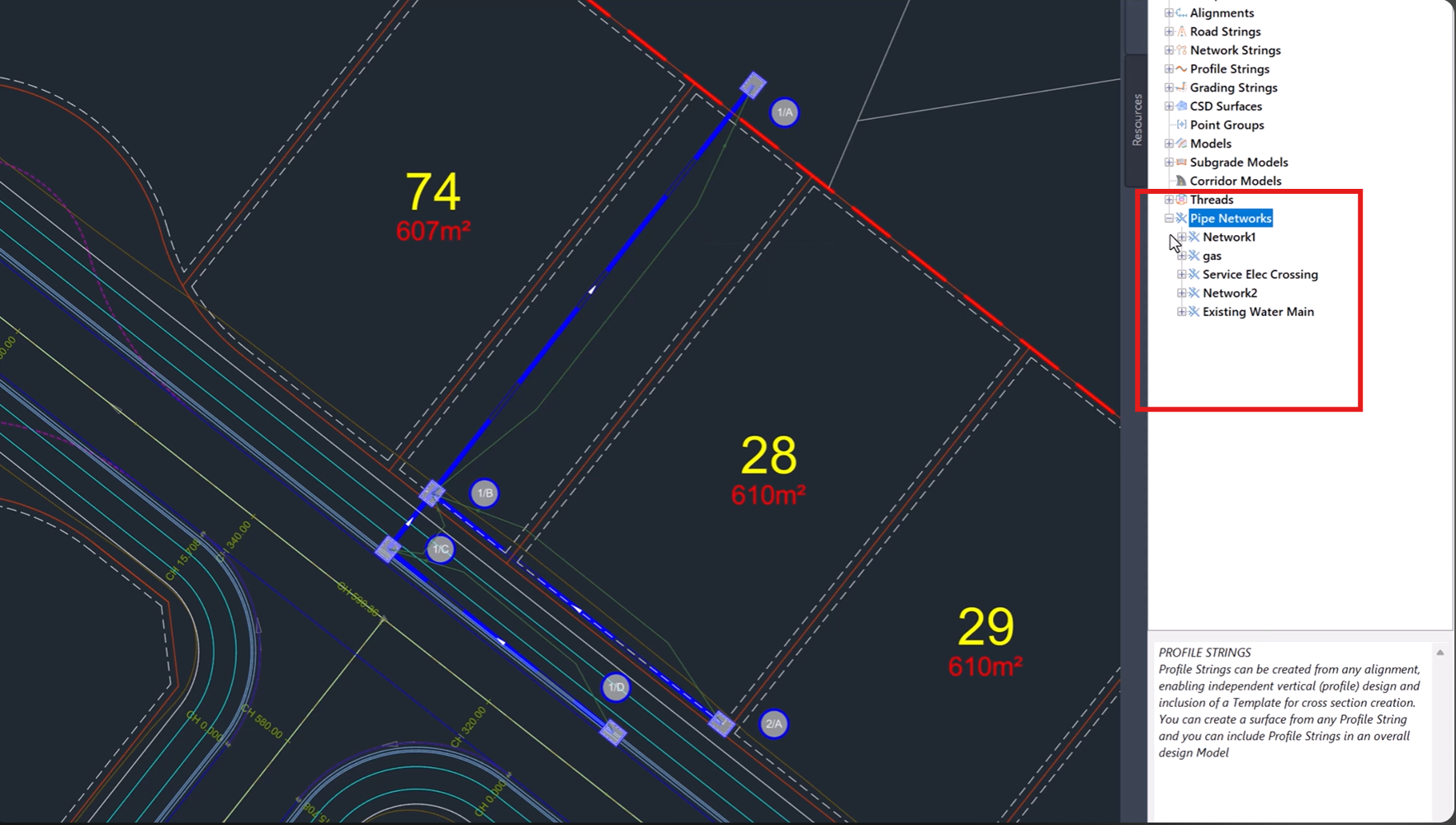
For the first time, pipe networks have a dedicated, organised home within the Civil Site Design Toolspace.
This new interface brings together all network elements into a single management environment, making it easier to navigate, review, and maintain drainage infrastructure throughout the design process.
Rather than searching through drawings or multiple dialogs, users can access key network components through a clear, structured hierarchy.
View Your Entire Network at a Glance
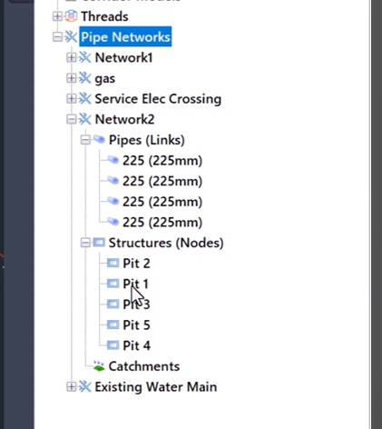
The new Pipe Network Toolspace provides a logical, hierarchical view of your drainage design, allowing you to easily navigate between:
-
Pipe networks
-
Pipes
-
Structures
-
Catchments
-
Associated network components
This organised approach improves project visibility and helps users quickly locate and manage specific elements within even the largest drainage systems.
By presenting network information in a familiar tree structure, the Toolspace makes network management more intuitive and efficient.
Simplify Drainage Network Management
Managing network components becomes significantly easier when all project information is available from a central location.
The Pipe Network Toolspace allows users to review and organise network assets without constantly switching
between commands or searching through drawing entities.
This streamlined workflow helps improve productivity while providing greater confidence that all network elements are properly coordinated.
Faster Long Section Plotting
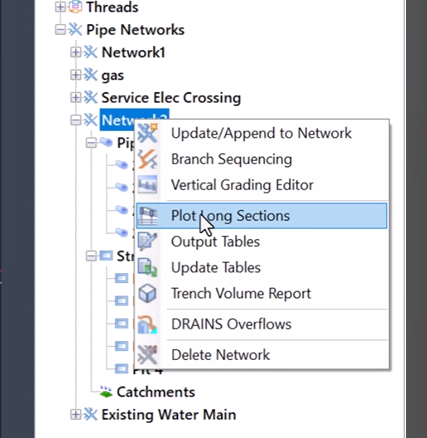
Long sections remain one of the most important outputs in drainage design.
The new Toolspace provides direct access to long section plotting tools, making it easier to generate and review drainage profiles throughout the project lifecycle.
With network data organised in a structured environment, producing long sections becomes a faster and more efficient process.
Streamlined Reporting and Exporting
In addition to network management and plotting capabilities, the Toolspace also simplifies reporting and data export workflows.
Users can quickly access options to:
-
Generate network reports
-
Review drainage information
-
Export network data
-
Share project outputs with stakeholders
Having these functions available within the same workspace reduces workflow interruptions and improves overall project efficiency.
Designed for Better Project Visibility
One of the greatest advantages of the new Pipe Network Toolspace is the improved visibility it provides across the entire drainage network.
Whether reviewing catchment information, inspecting pipe connectivity, or generating project deliverables, engineers can work from a single, organised interface that keeps all critical information readily accessible.
This enhanced visibility helps improve coordination, reduce oversight, and support better design decision-making throughout the project.
Key Benefits of the Pipe Network Toolspace
-
Dedicated workspace for pipe networks
-
Structured hierarchical network navigation
-
Centralised management of pipes, structures, and catchments
-
Faster access to long section plotting
-
Streamlined reporting workflows
-
Simplified network exporting
-
Improved project visibility and organisation
-
More efficient drainage design management
A Smarter Approach to Drainage Design
The introduction of the Pipe Network Toolspace represents a significant improvement to how drainage networks are managed within Civil Site Design.
By bringing network navigation, management, plotting, reporting, and exporting together into a single environment, V.27 helps engineers work more efficiently while maintaining complete visibility over their drainage infrastructure.
The result is a cleaner, more organised workflow that makes managing complex pipe networks easier than ever.
Available Now in Civil Site Design v27
The new Pipe Network Toolspace is available as part of Civil Site Design v27 and forms another key enhancement in the platform’s ongoing commitment to improving productivity and usability.
Explore the new centralised workspace and discover a faster, more organised way to manage your drainage networks from concept through to project delivery.
Civil Site Design/Corridor EZ V26 introduces support for IFC 4.3 export, giving users a powerful new way to share detailed 3D models with full classification and geometry data. This enhancement allows designers to export corridor models, road elements, and subgrade components as fully structured, BIM-ready files compatible with a wide range of IFC viewers […]
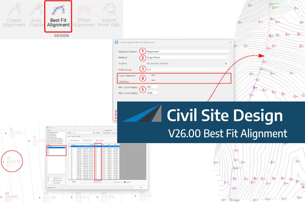
A new feature of Civil Site Design V26 is the Best Fit Alignment command. This command is available to AutoCAD and BricsCAD users and allows you to create an alignment based on Cogo Point or polyline data. When the command is run, the Best Fit algorithm analyses the Cogo Points in the specified Point […]

One of the exciting new features in the Civil Site Design V26 and Stringer Topo V26 release is the Surface from LAS command. Often LiDAR and point cloud data is saved as a LAS file, which previously required interpreting in another software prior to being imported to create a surface. This new command allows you […]
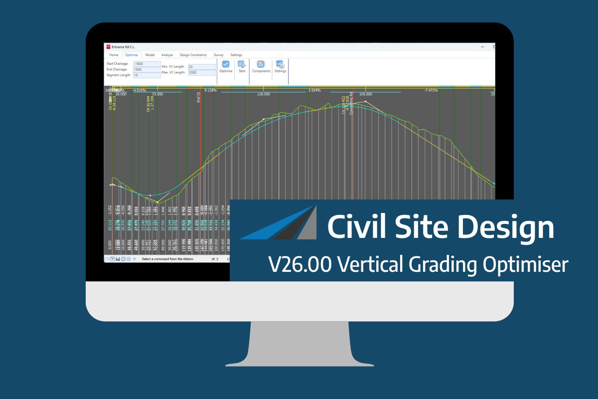
An exciting new tool in Civil Site Design/Corridor EZ v26 is the Vertical Grading Optimizer which can create vertical design profiles based on the parameters you set. Previously, the vertical best fit design profile was based on matching closely to the terrain (within preset cut/fill depths) and adding vertical curves. Mostly, you would remove these […]