We are pleased to announce the release of Stringer Topo V25.00. This version includes new features and improvements that aim to streamline your surveys within the CAD environment.
Stringer Topo V25.00 is available on the following platforms:
- AutoCAD 2019 to AutoCAD 2025
- BricsCAD V22 to BricsCAD V24
- Civil 3D 2019 to Civil 3D 2025
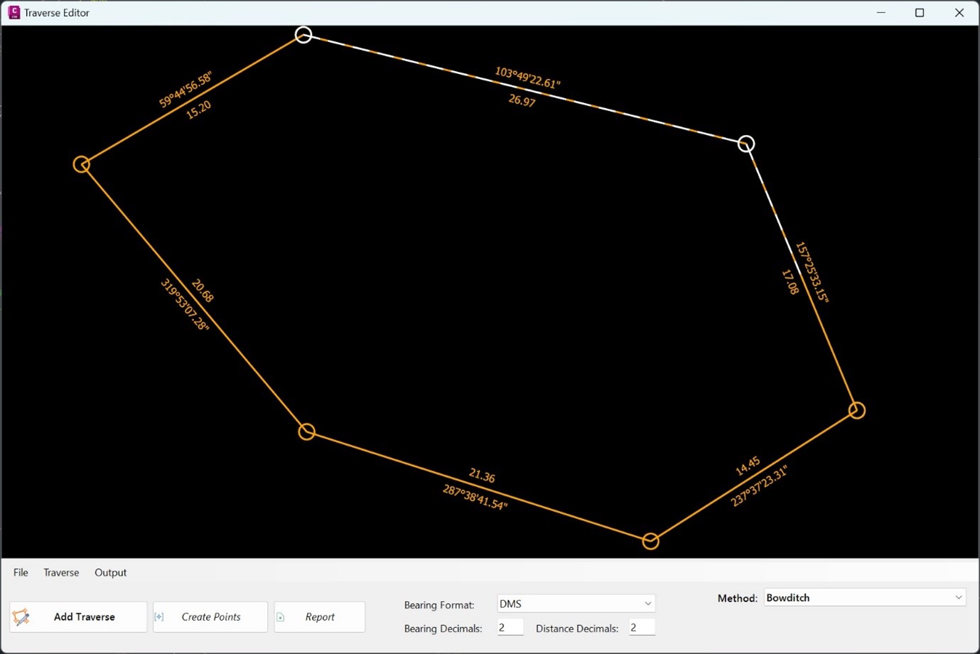
Traverse Editor
One of our bigger additions to Stringer Topo is the addition of a new Traverse Editor. This allows users to select the points of their traverse and visualise it before running one of four key adjustment methods:
- Bowditch
- Transit
- Crandall
- Grant Line
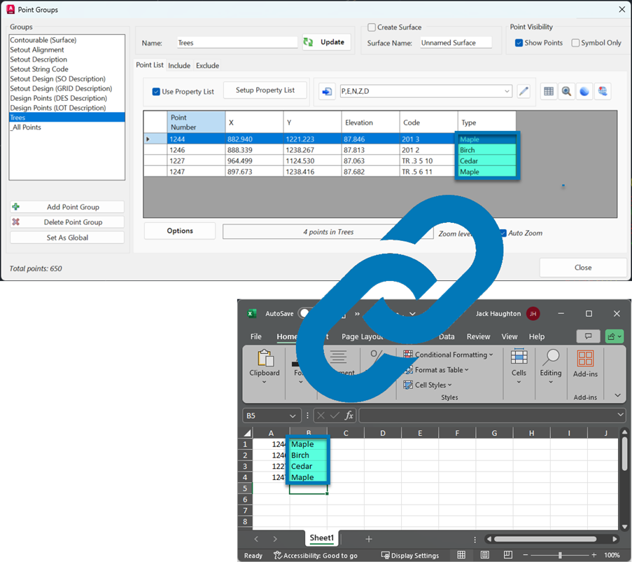
Linking COGO Points with Excel
Recognising the power of spreadsheets to quickly update non-geometric point properties (such as tree type and condition) we have implemented a link between Excel and COGO Points in Stringer Topo. Users can now:
- Export point geometry and property date across to Excel
- Link Excel spreadsheet/s to COGO point properties, enabling Excel spreadsheet edits to drive point geomery and property information
There are four commands to provide interoperability with Excel:
- Excel Export: structure an Excel file to contain your point data
- Excel Import: link point dat to an Excel file
- Sync Links: click-button option to update COGO points in the drawing from changes in Excel
- Excel Viewer: a simple spreadsheet editor for .xls files (if you don’t own Microsoft Excel or equivalent)
2D Transformations
In response to customer requests we have added options to Move, Scale, Rotate and Offset all points in a point group, without affecting point elevations.
![]()
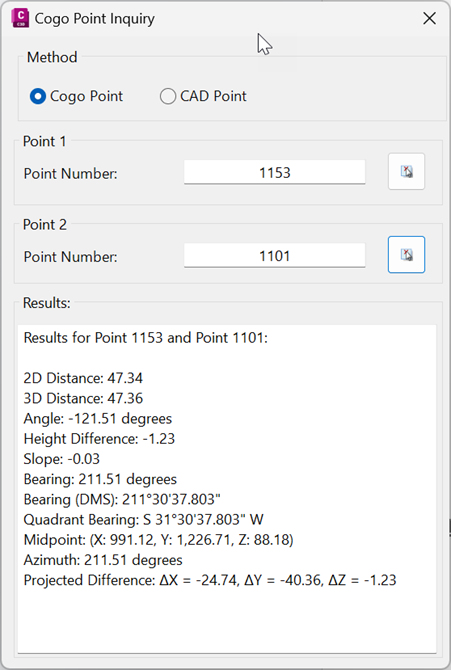
Inquire Points
To simplify querying the data in the drawing, users now have access to the new Inquire Points command. This allows users to report differences between two selected points.

The latest releases of Civil Site Design V26.10 and Stringer Topo V26.10 are here! These updates focus on addressing customer-reported issues, improving pack mode performance, and introducing new features and efficiency enhancements for working with COGO points and Survey Strings. Civil Site Design V26.10 is available on the following platforms: Civil 3D 2021 to Civil […]

Our streamlined design process shaves hours and days off your Civil 3D projects, including the creation of a Civil 3D Corridor complete with multiple regions, target mapping, and assemblies, at the click of a button. We always aimed to make the corridor like you would, reusing and consolidating similar assemblies wherever possible. So, for the […]

