We’ve enhanced the superelevation tools to make it easier for you to quickly and easily assess output of rules-based superelevation, and to make it simple for you to use this tool to vary pavement crossfalls and widths.
To make things easier with rules-based application of superelevation, we’ve colour coded each curve to highlight them, and we’ve colour codes issues with superelevation (like curve radius being too small or overlapping superelevation lengths) with a pink row.

Most importantly, you can easily apply linear transitions of pavement widening and/or pavement crossfall, over any chainage ranges.
Previously, we made you fill out every value (for crossfall or width) where you added a chainage – this made things awkward because if you had a widening going from, say, chainage 100 to 150, but you also had chainage entries at, say, chainage 120 and 130, then you had to manually interpolate what the widths would be at these intermediate chainages.
Now, we interpolate the value at any cell you leave blank. What this means is that you can separately manage the pavement crossfalls or the pavement widening, left and right. Add chainages at the locations where you want the changes to start and stop.

Rather work with Excel? We’ve added file export functionality to push the data out to Excel, and to read the data back in. In Excel you just type in chainages, fill out the key locations with crossfalls and widths, then load it back in.

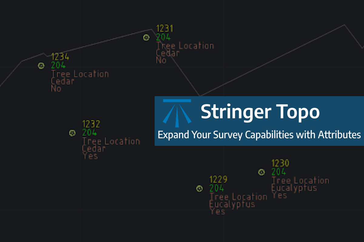
Field attributes provide Surveyors with the ability to include additional data in their Survey pickup of points. With Stringer Topo V26 users can now include additional data (attribute data) with their COGO points and survey strings for review, editing and output from their drawing. There are a number of ways to add attributes to your […]
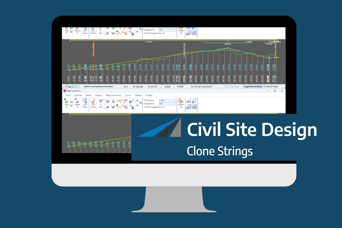
In the Civil Site Design v26 release for AutoCAD and BricsCAD, a new Clone String command has been added. This command allows users to create a clone of an existing string as a profile string including the alignment and vertical profile. This command turns what was a multi-step process into a one step process. You […]
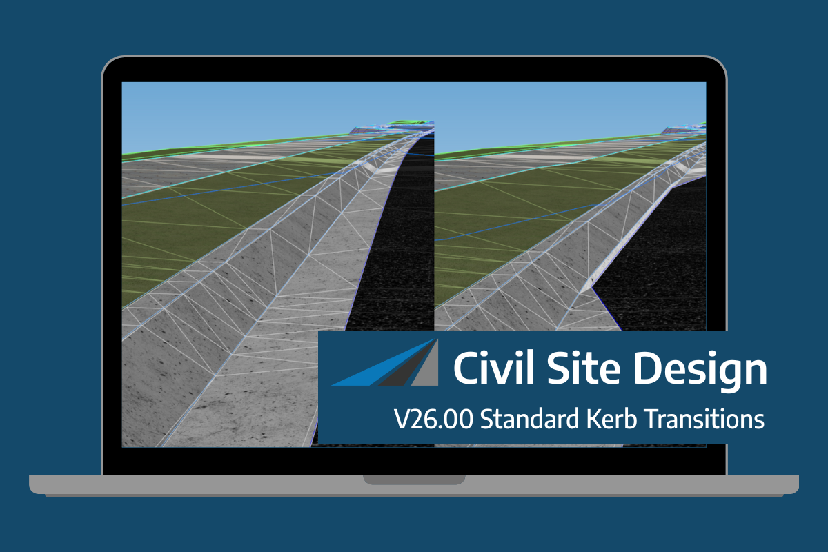
Civil Site Design/Corridor EZ v26 delivers a major upgrade to its Custom Variations functionality with the introduction of Standard Kerb Transitions. Since v25, Custom Variations have been a core feature of Civil Site Design/Corridor EZ, allowing users to apply conditional logic and geometry overrides to cross sections at specified chainages. With v26, this functionality is […]
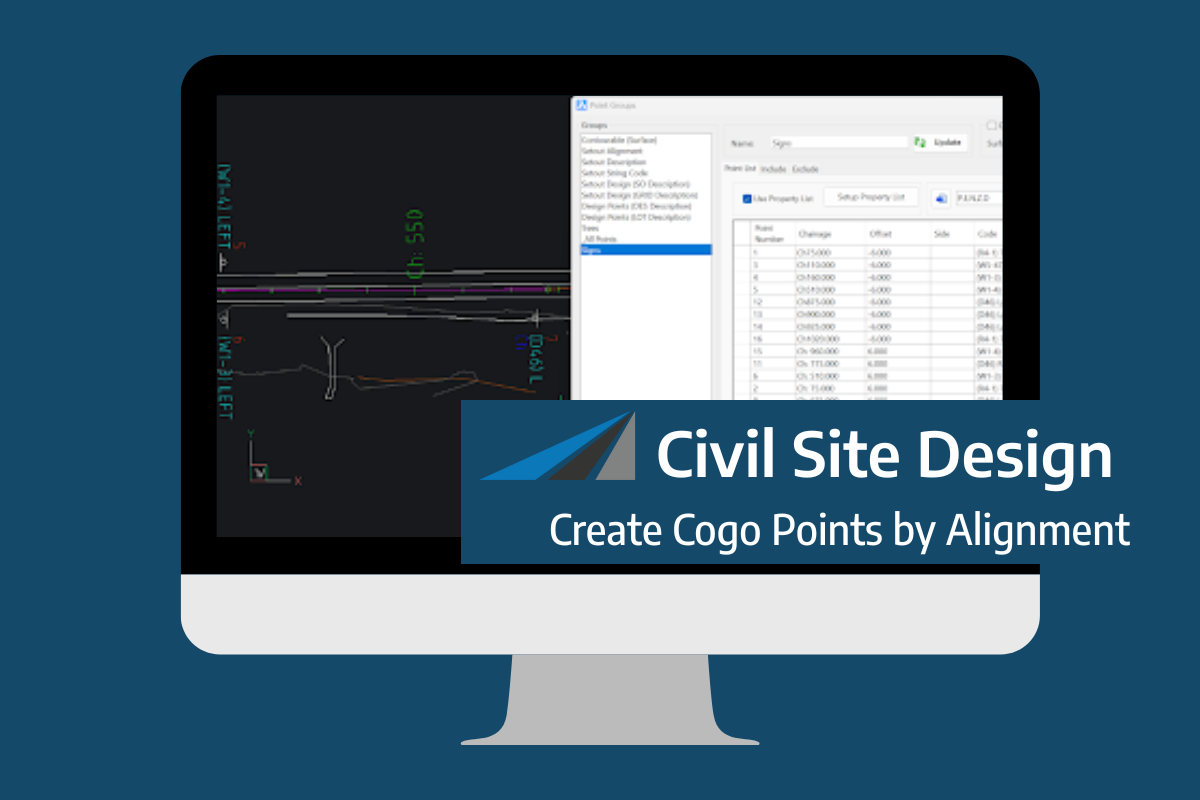
Civil Site Design V26 introduces the new command Import Cogo Point File (by Alignment). This tool allows you to import a file that specifies chainage and offset along an alignment for points to be created. The command is available for Civil Site Design and Stringer across all base platforms. The command can be found at […]