In conjunction with our partners Civil Survey Solutions, we are excited to announce the following upcoming training courses for our products Civil Site Design and Stringer Topo.
The courses are delivered by our experts and the training team at Civil Survey Solutions. As an Authorised Autodesk Training Center and Application Developer, you can trust that these courses will provide you with real-world project experience to assist your team with skills updates, project setup, application customisation and workflow consultation.
Civil Site Design
Civil Site Design | Road Reconstruction (Online – Instructor Led)
27 Feb – 1 Mar 2024 (4 Half Day Sessions)
Click here to register or learn more
Civil Site Design | Fundamentals (Online – Instructor Led)
7-8 May 2024 (2 Half Day Sessions)
Click here to register or learn more
Civil Site Design | Road Subdivision (Online – Instructor Led)
21 – 24 May 2024 (4 Half Day Sessions)
Click here to register or learn more
Civil Site Design | Pipes (Online – Instructor Led)
11-14 June 2024 (4 Half Day Sessions)
Click here to register or learn more
Stringer Topo
Stringer Topo | For CAD Platforms (Online – Instructor Led)
4-7 June 2024 (4 Half Day Sessions)
Click here to register or learn more
Stringer Topo | For Civil 3D (Online – Instructor Led)
25-28 June 2024 (4 Half Day Sessions)
Click here to register or learn more
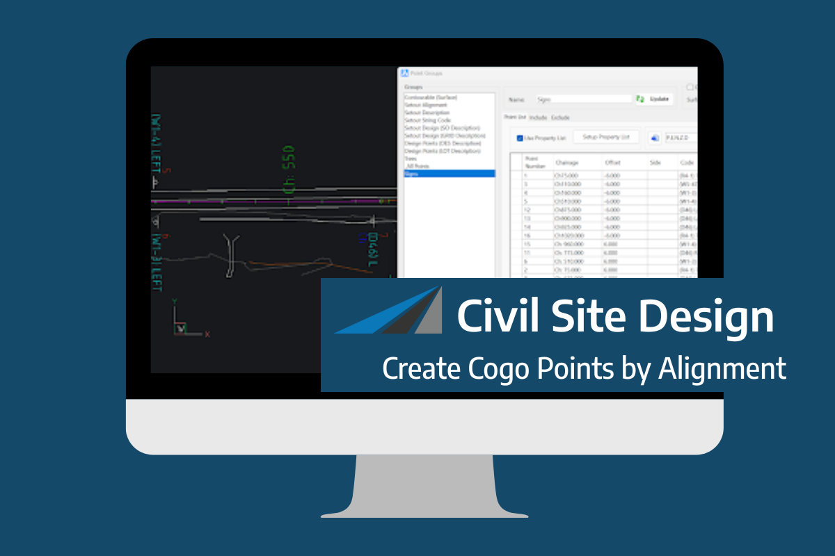
Civil Site Design V26 introduces the new command Import Cogo Point File (by Alignment). This tool allows you to import a file that specifies chainage and offset along an alignment for points to be created. The command is available for Civil Site Design and Stringer across all base platforms. The command can be found at […]
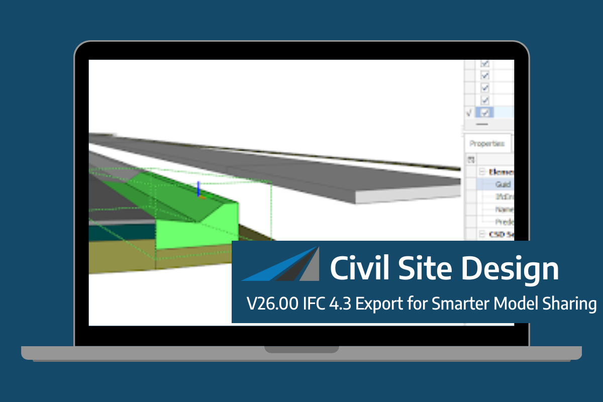
Civil Site Design/Corridor EZ V26 introduces support for IFC 4.3 export, giving users a powerful new way to share detailed 3D models with full classification and geometry data. This enhancement allows designers to export corridor models, road elements, and subgrade components as fully structured, BIM-ready files compatible with a wide range of IFC viewers […]
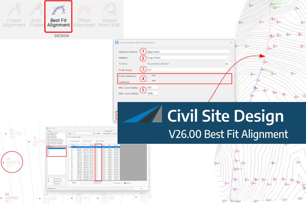
A new feature of Civil Site Design V26 is the Best Fit Alignment command. This command is available to AutoCAD and BricsCAD users and allows you to create an alignment based on Cogo Point or polyline data. When the command is run, the Best Fit algorithm analyses the Cogo Points in the specified Point […]