This document provides a simple guide on upgrading your V25 licenses to V26.
No new license key is required!
Easy Upgrade Process
Upgrading from V25 to V26 licenses is straight forward. For standalone you can upgrade simply by downloading and installing the latest software version. For Network you simply need to upgrade the server XML and instruct users to download the latest software.
Switch to Cloud Licensing (Recommended)
Simplify license management and increase flexibility by transitioning to cloud licensing. Find out more
Evaluation Process
If you would like to evaluate Civil Site Design or Stringer Topo please view this article on how to request an evaluation from the Civil Survey Applications License manager: Get the Guide.
Upgrading from V24 to V26
If you have your maintenance/expiry date of your V24 license is after {Release Date}
you will have been issued a new license key from our new licensing system last year. This license can be used to activate V26. Your primary and secondary administrator can retrieve this key from the Civil Survey Applications Customer Portal: https://portal.civilsurveyapplications.com/
Once you have retrieved your license key you can activate your license following the steps in the Licensing guide
Important Requirements
Upgrading to V26 is subject to your subscription or maintenance being current at the time of the V26 release.
Standalone (Computer Bound) Licensing Upgrade
Steps for Upgrade
- Download: Download the latest V26 software from the official website: https://download.civilsurveyapplications.com/
- Install: Install the software on your computer.
Note: Running a command before completing steps 3-4, will show a License not found splash screen. However this will also initiate the upgrade process & you will then be able to run a command on second attempt
- Refresh: Open the CSA License Manager from the ribbon interface
- Activate: Your V26 license will be re-activated automatically for active subscription/maintenance customers.
Full installation and licensing details are contained in the Installation and Licensing Guide.
If you encounter any issues during the upgrade process, please submit a ticket via our helpdesk: helpdesk.civilsurveyapplications.com/.
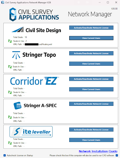
Network (Multi-User On Premise) Licensing Upgrade
Network Server Upgrade Guide
This guide is for administrators who are currently using a V25 Network License & who wish to upgrade to V26
Before end users download and install the latest version of the software you must first upgrade the Civil Survey Applications Network License Manager.
- On your server/shared device download & install the Latest Network License Manager: https://downloads.civilsurveysolutions.com/licensing/CSANetworkManager.exe
- Once installed right click the CSA Network Manager & select “Run as administrator”
- Click Activate/Deactivate Network license for the network license you wish to update
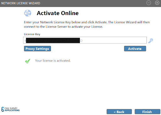
4. The following Screen will display a message that your license key does not correspond to the current version of your product. Select “Activate your license”
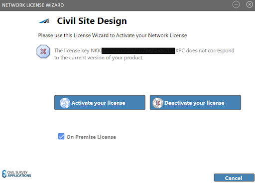
5. Your existing license path will be pre-populated with the license file path. Click Register
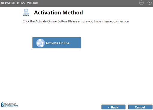
6. Click Next
7. Click Activate Online
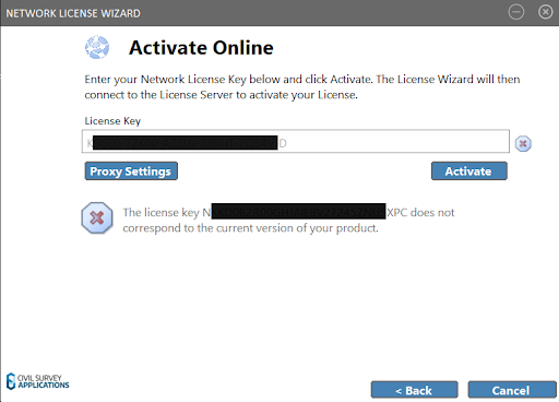
8. Your activation key, or computer key should be pre filled alerting you that it does not correspond to the current version. Click Activate to update it to the latest version.
9. Your Network license should now be upgraded and ready for use
10. You may now instruct your users to complete the steps below to upgrade the software on their machine
V25 to V26 Network User Upgrade Steps
This section is for users who are currently using a V25 Network License & who need to upgrade to V26
Note: Before these steps can be completed your network administrators must complete the above steps in the Network Server Upgrade Guide.
Steps for Upgrade
- Download: Download the latest V26 software from the official website: https://download.civilsurveyapplications.com/
- Install: Install the software on your computer.
- Refresh: Open the license manager using the ribbon
Activation: Your V26 license will be re-activated automatically if your subscription/maintenance is valid.
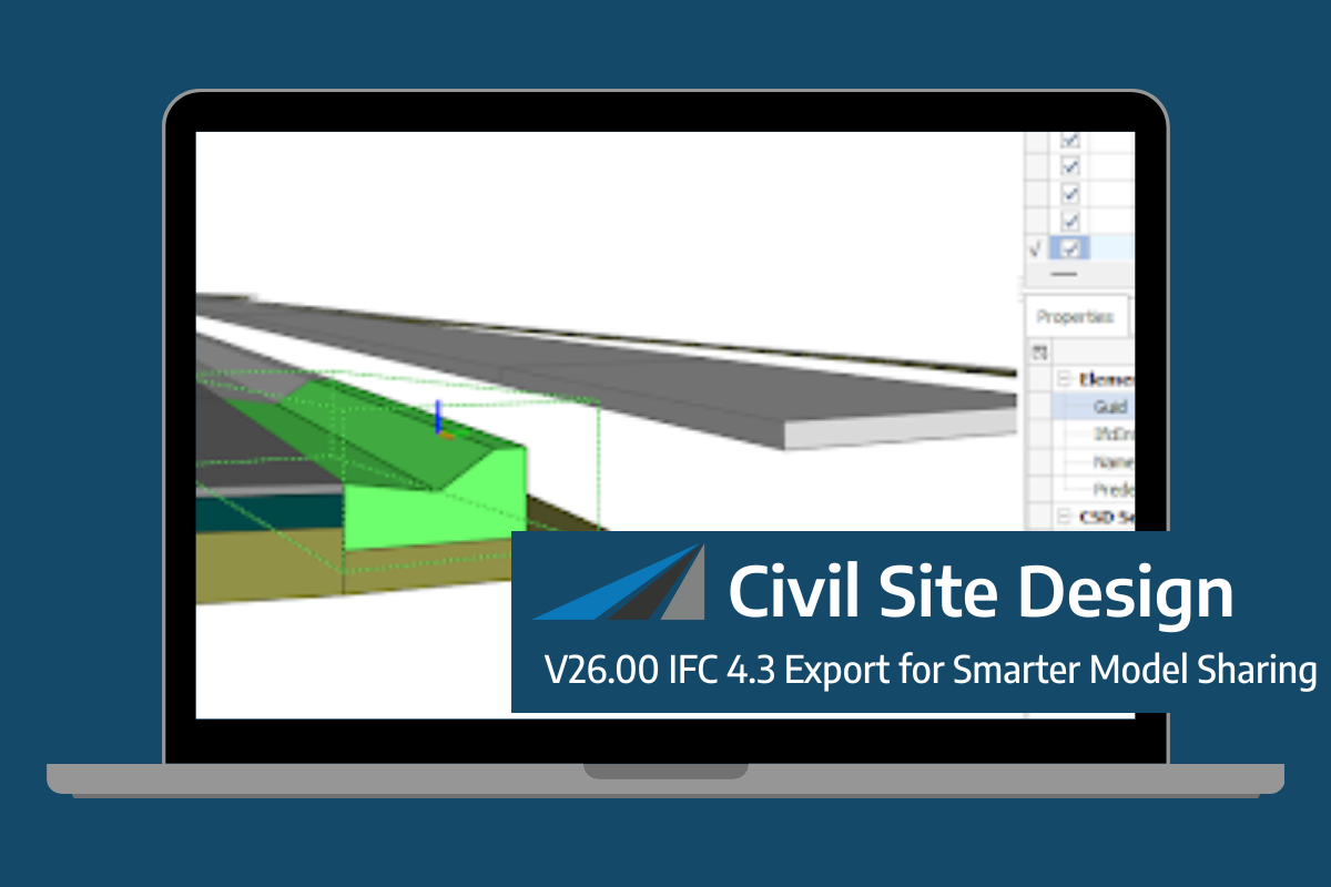
Civil Site Design V26 introduces support for IFC 4.3 export, giving users a powerful new way to share detailed 3D models with full classification and geometry data. This enhancement allows designers to export corridor models, road elements, and subgrade components as fully structured, BIM-ready files compatible with a wide range of IFC viewers and […]
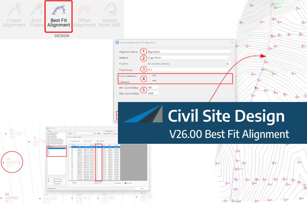
A new feature of Civil Site Design V26 is the Best Fit Alignment command. This command is available to AutoCAD and BricsCAD users and allows you to create an alignment based on Cogo Point or polyline data. When the command is run, the Best Fit algorithm analyses the Cogo Points in the specified Point […]

One of the exciting new features in the Civil Site Design V26 and Stringer Topo V26 release is the Surface from LAS command. Often LiDAR and point cloud data is saved as a LAS file, which previously required interpreting in another software prior to being imported to create a surface. This new command allows you […]
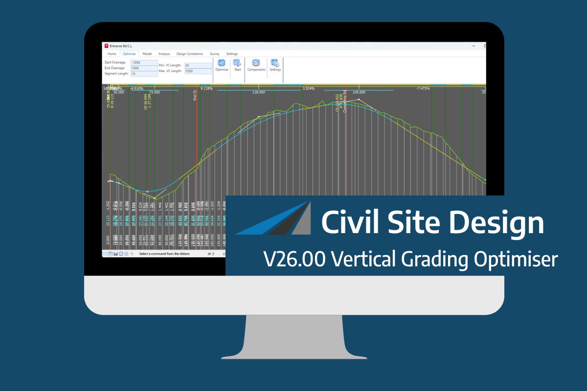
An exciting new tool in Civil Site Design v26 is the Vertical Grading Optimiser which can create vertical design profiles based on the parameters you set. Previously, the vertical best fit design profile was based on matching closely to the terrain (within preset cut/fill depths) and adding vertical curves. Mostly, you would remove these and […]