Civil Site Design/Corridor EZ v26 delivers a major upgrade to its Custom Variations functionality with the introduction of Standard Kerb Transitions.
Since v25, Custom Variations have been a core feature of Civil Site Design/Corridor EZ, allowing users to apply conditional logic and geometry overrides to cross sections at specified chainages. With v26, this functionality is significantly expanded through the inclusion of pre-configured kerb transition scripts. The Standard Kerb Transitions are installed with the software (not available via downloads) and provide ready-to-use profiles tailored to specific Australian States and Territories, such as Queensland, New South Wales, and others.
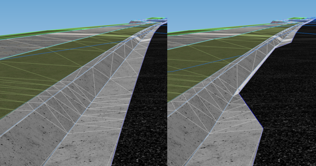
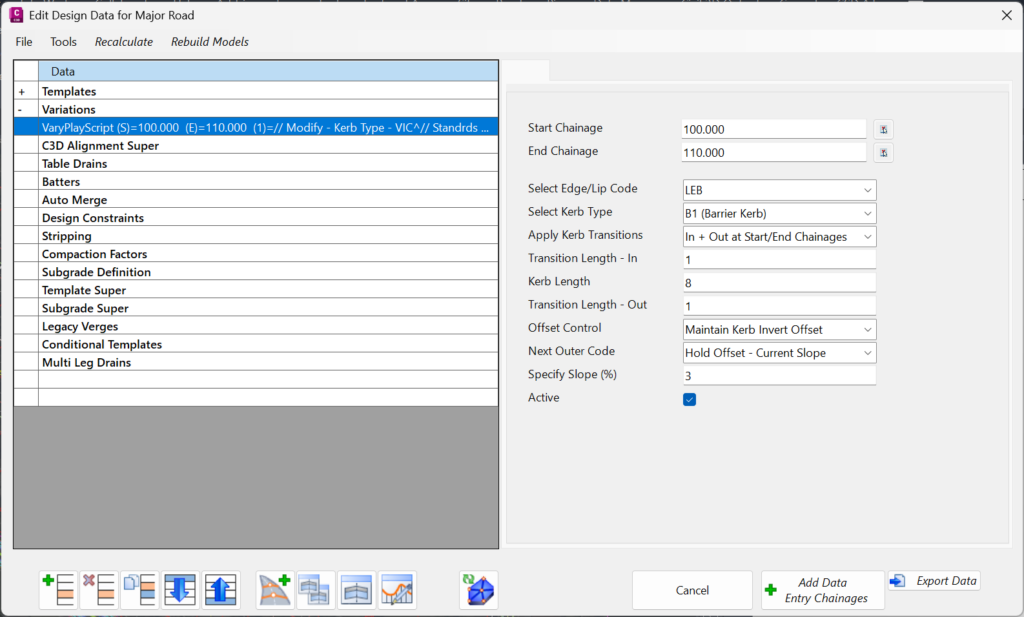
Each transition script contains a group of kerb types that can be applied directly within the Custom Variation. Users simply double-click on a variation, select Custom Variation, and navigate to the Standard Kerb Transitions folder. From there, designers can assign start and end chainages, define in/out transition lengths, and maintain control over key feature codes like edge of bitumen, lip, or invert.
What sets this apart is the precision with which users can control geometric behaviour. Variations can hold offsets, maintain slopes, or apply fixed slopes to adjacent codes—ideal for complex urban design environments. This ensures seamless integration of kerb changes while preserving surface integrity and modelling accuracy.

The latest releases of Civil Site Design V26.10 and Stringer Topo V26.10 are here! These updates focus on addressing customer-reported issues, improving pack mode performance, and introducing new features and efficiency enhancements for working with COGO points and Survey Strings. Civil Site Design V26.10 is available on the following platforms: Civil 3D 2021 to Civil […]

Our streamlined design process shaves hours and days off your Civil 3D projects, including the creation of a Civil 3D Corridor complete with multiple regions, target mapping, and assemblies, at the click of a button. We always aimed to make the corridor like you would, reusing and consolidating similar assemblies wherever possible. So, for the […]

