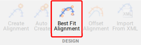
A new feature of Civil Site Design V26 is the Best Fit Alignment command. This command is available to AutoCAD and BricsCAD users and allows you to create an alignment based on Cogo Point or polyline data.
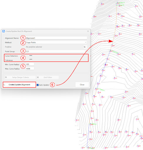
When the command is run, the Best Fit algorithm analyses the Cogo Points in the specified Point Group or the vertices of the selected Polyline and fits a series of tangents and curves to create a new Alignment that describes these inputs. The user is able to change the radii, curve detection and tolerance of the algorithm to refine the fit to the original data.
How it Works
This command allows you to build a Best Fit Alignment using Cogo points or existing polylines. The command is available from the ribbon:
Alignments >> Design >> Best Fit Alignment
Before generating a Best Fit Alignment from Cogo points, create a point group of the points to use for the alignment creation.
Click here (https://www.help.civilsurveysolutions.com/CSD/HelpSystem/CSD_for_Civil_3D/index.htm#t=Commands%2FPointGroups%2FPointGroups.htm&rhsearch=point%20group&rhhlterm=point%20points%20groups%20group ) to learn more about point groups.
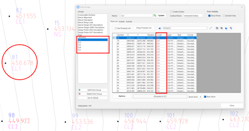
Once the Point Group for the alignment has been defined, run the Best Fit Alignment command and complete the follow:
- Give the alignment a name.
- Choose the Best Fit method: Cogo Points or Polyline.
- Choose the desired Point Group or Polyline.
- Slide the bars left and right to adjust the curve detection and tolerance of the Best Fit algorithm until the optimal fit is achieved.
- Change the minimum and maximum curve radii as needed.
- Select Create/Update Alignment.
Once the Best Fit Alignment has been created, use the Edit Alignment command for further modifications.
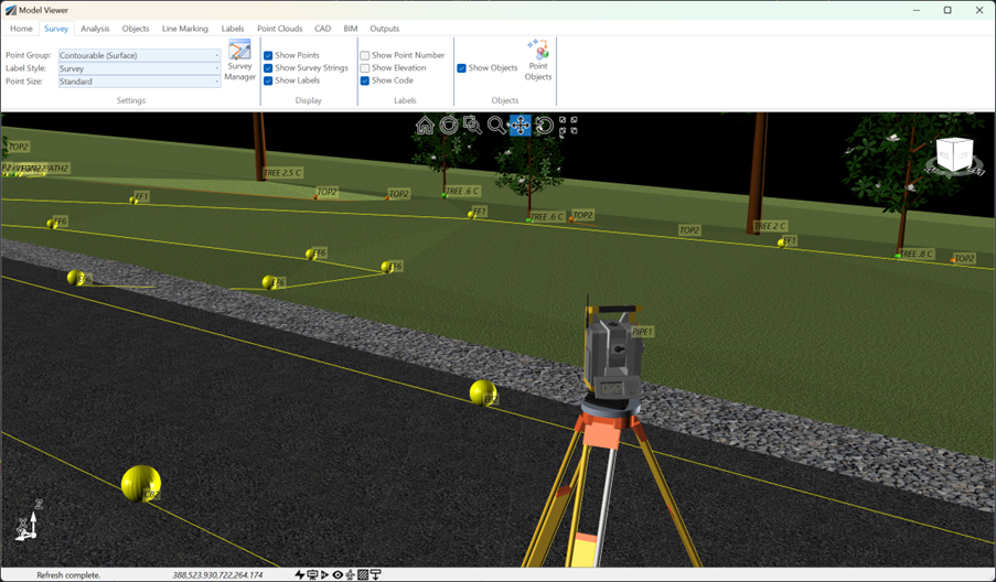
See how Civil Site Design efficiently incorporates and displays survey data, specifically cogo points and survey strings, within your design framework. This article explores this through the lens of a rural road project, demonstrating how cogo points and survey strings from the topographical survey are seamlessly integrated and visualised in Civil Site Design's Cross Section Viewer, VGE (Vertical Grading Editor), and 3D viewer (Model Viewer).
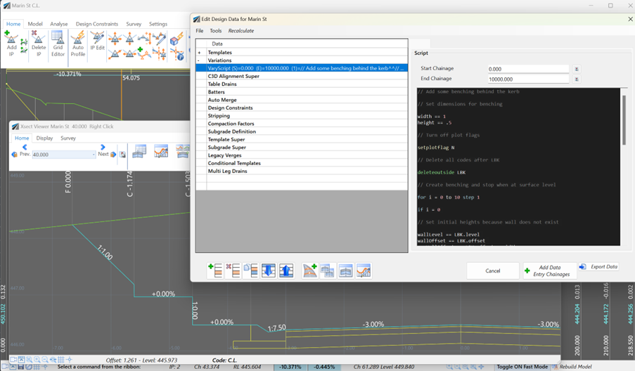
Unlock advanced cross-section editing in Civil Site Design with ScriptX, a user-friendly scripting tool for precision and customization. Easily integrate your scripts into the design process, and collaborate effortlessly with a shared library of scripts. This article will explore ScriptX's capabilities and provide download sample scripts.
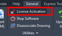
At times you may need to move your standalone Civil Site Design or Stringer license due to hardware failure, formatting of a workstation (PC) or moving to another PC. Here are the instructions on how to complete this process both if the license is accessible or inaccessible.
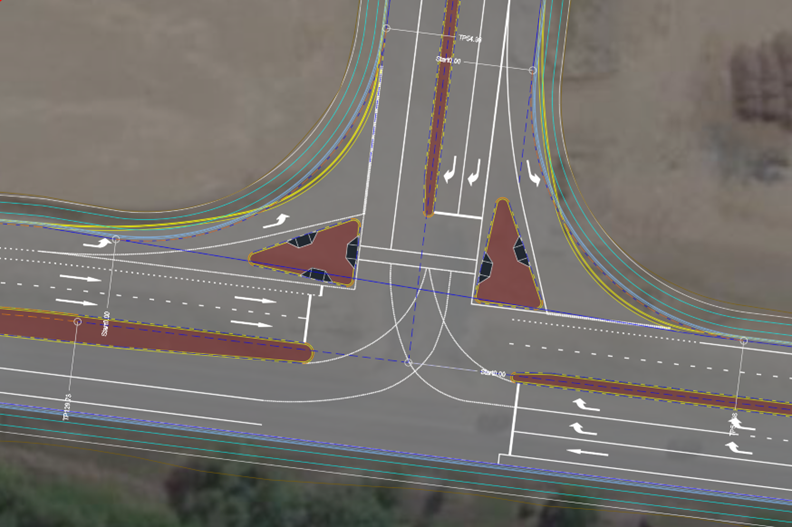
Revolutionise your Civil Site Design with Project Assist: Automating medians and splitter islands effortlessly. This AI-powered tool streamlines island integration by detecting alignments, automatically trimming road strings, and enhancing precision with minimal manual input.