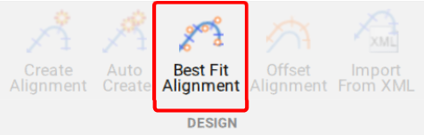
A new feature of Civil Site Design V26 is the Best Fit Alignment command. This command is available to AutoCAD and BricsCAD users and allows you to create an alignment based on Cogo Point or polyline data.
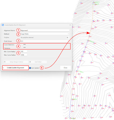
When the command is run, the Best Fit algorithm analyses the Cogo Points in the specified Point Group or the vertices of the selected Polyline and fits a series of tangents and curves to create a new Alignment that describes these inputs. The user is able to change the radii, curve detection and tolerance of the algorithm to refine the fit to the original data.
How it Works
This command allows you to build a Best Fit Alignment using Cogo points or existing polylines. The command is available from the ribbon:
Alignments >> Design >> Best Fit Alignment
Before generating a Best Fit Alignment from Cogo points, create a point group of the points to use for the alignment creation.
Click here (https://www.help.civilsurveysolutions.com/CSD/HelpSystem/CSD_for_Civil_3D/index.htm#t=Commands%2FPointGroups%2FPointGroups.htm&rhsearch=point%20group&rhhlterm=point%20points%20groups%20group ) to learn more about point groups.
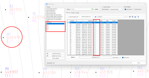
Once the Point Group for the alignment has been defined, run the Best Fit Alignment command and complete the follow:
- Give the alignment a name.
- Choose the Best Fit method: Cogo Points or Polyline.
- Choose the desired Point Group or Polyline.
- Slide the bars left and right to adjust the curve detection and tolerance of the Best Fit algorithm until the optimal fit is achieved.
- Change the minimum and maximum curve radii as needed.
- Select Create/Update Alignment.
Once the Best Fit Alignment has been created, use the Edit Alignment command for further modifications.
Check out the performance improvements we have introduced for all Civil 3D Corridor creators out there!
-
Check out the performance improvements we've introduced into Civil Site Design V24.20 when you're working in the Vertical Grading Editor window.
The Survey String Settings command is key to controlling how your Point Codes are used in the creation of breaklines, addition of offsets and the creation of 2D and 3D linework.
Stringer Topo V24.20 has been released to support the BricsCAD V24 (as well as current releases of Autodesk software), including a number of new and improved features.