With the release of V24 has come a number of new and improved features. Join us as we explore the major functionality update, Toolspace, which has been developed to enhance the user experience for operators at all levels.
Also covered in this webinar will be the following topics:
- Template Packing (Sharing templates)
- Model Viewer – Surface Analysis
- Model Viewer – Catchment Analysis
- Converting 2D Objects (for surface creation)
Civil Site Design V24: New Features Webinar

Date: Thursday 27th April 2023
Register here : https://us06web.zoom.us/webinar/register/WN_pmOvQkGJTPCJq-lxu9-vQQ
Date: Thursday 3rd May 2023
Register Here: https://us06web.zoom.us/webinar/register/WN_XPTsPJFsSLm074s9BC7Q1g
If you are currently using Legacy Stringer Topo and are interested in transitioning to the new dynamic version of Stringer Topo – but are concerned about migrating your current settings? These webinars will walk you through how easy the transition is and the workflow of transferring settings from Legacy Stringer to the current version based […]
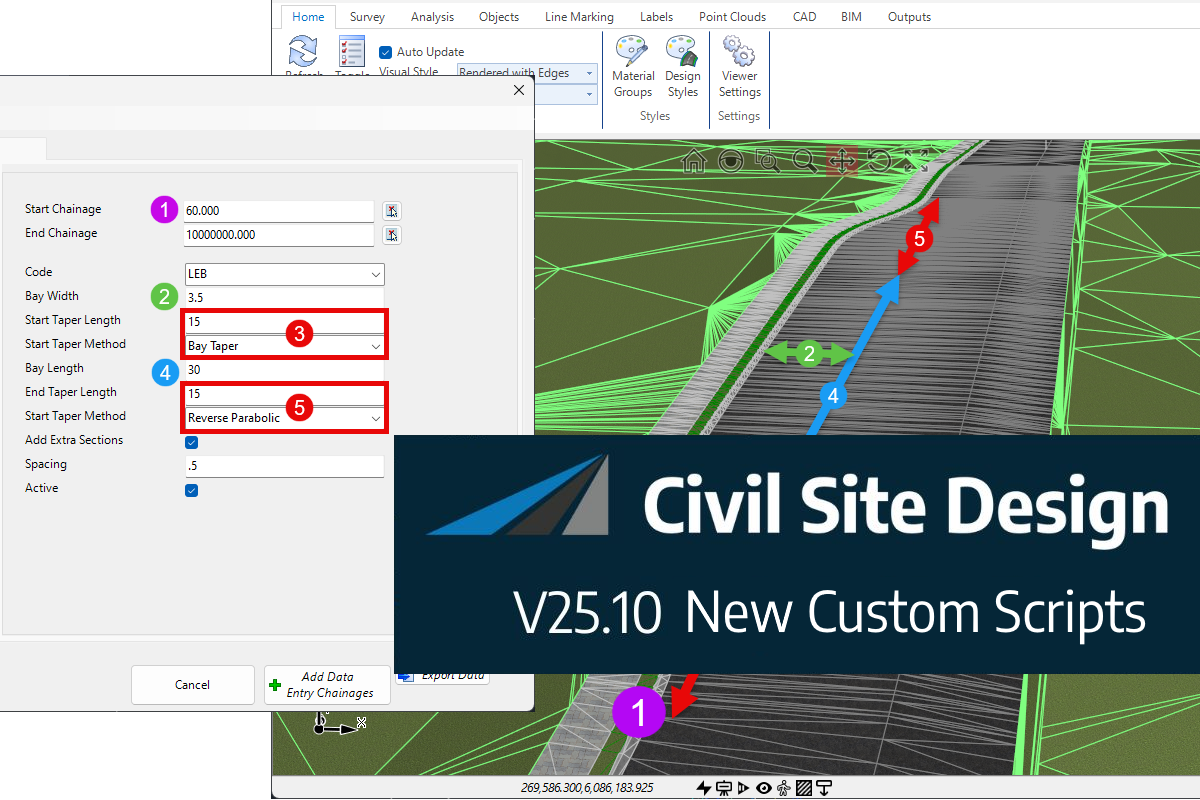
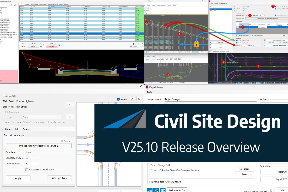
In this webinar, join our experts, Todd Brewster and Jonathan Taylor as they unpack some of the major updates within Civil Site Design V25.10. 0:00 Introduction 5:08 Project Storage 24:48 Intersection Manager 36:50 Sectional Volumes & Multi Viewer 54:16 Reference Profiles 1:12:19 Projected Profiles (Civil 3D only) Key features and improvements of Civil Site Design […]