It can be frustrating having survey data that has a common Z value on the objects – zero. Manual editing of a survey drawing can be very time-consuming, elevating objects before design can even begin to have a working base surface to design on.
With the new Convert 2D Objects, Civil Site Design can read your 2D objects, such as text or block attributes and convert them into dynamic, elevated Cogo Points. The result? A live surface onto which design can begin.
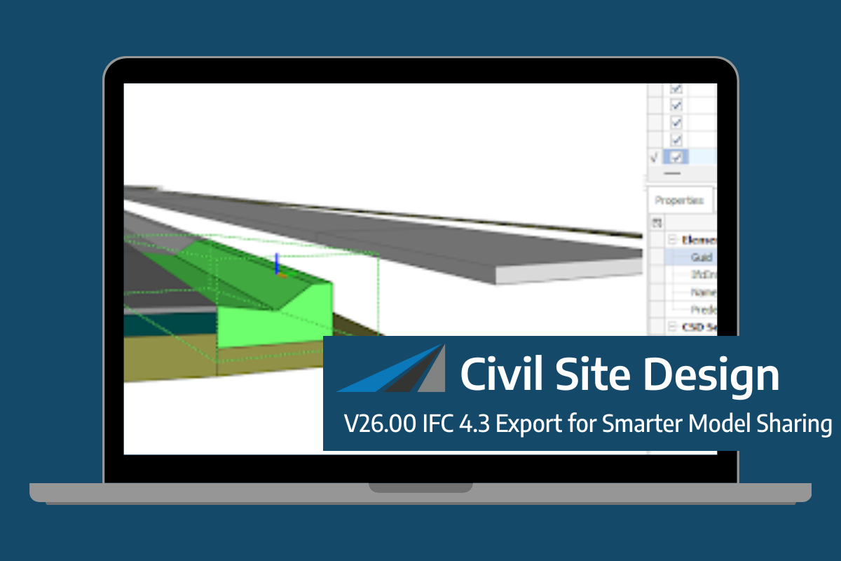
Civil Site Design/Corridor EZ V26 introduces support for IFC 4.3 export, giving users a powerful new way to share detailed 3D models with full classification and geometry data. This enhancement allows designers to export corridor models, road elements, and subgrade components as fully structured, BIM-ready files compatible with a wide range of IFC viewers […]
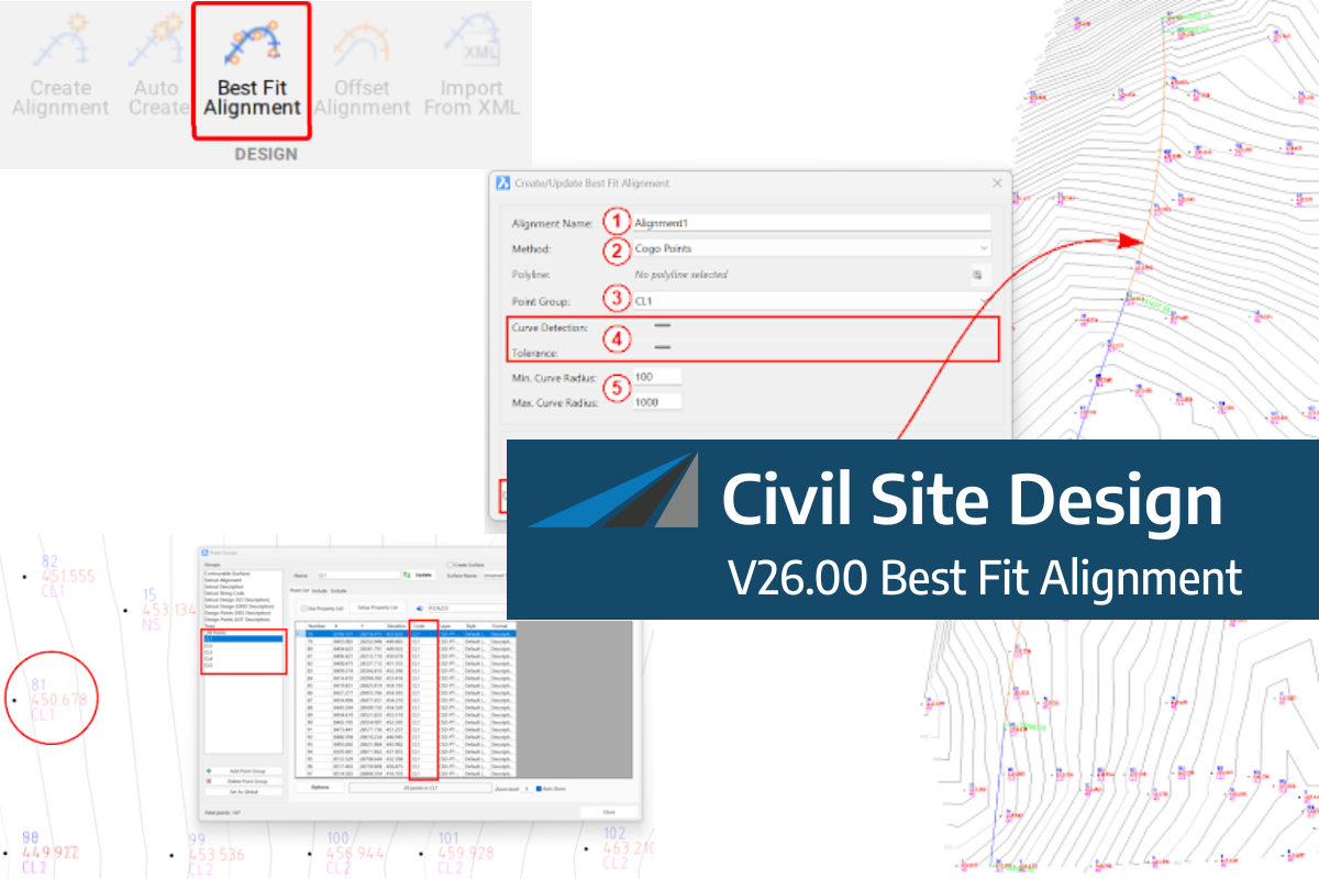
A new feature of Civil Site Design V26 is the Best Fit Alignment command. This command is available to AutoCAD and BricsCAD users and allows you to create an alignment based on Cogo Point or polyline data. When the command is run, the Best Fit algorithm analyses the Cogo Points in the specified Point […]

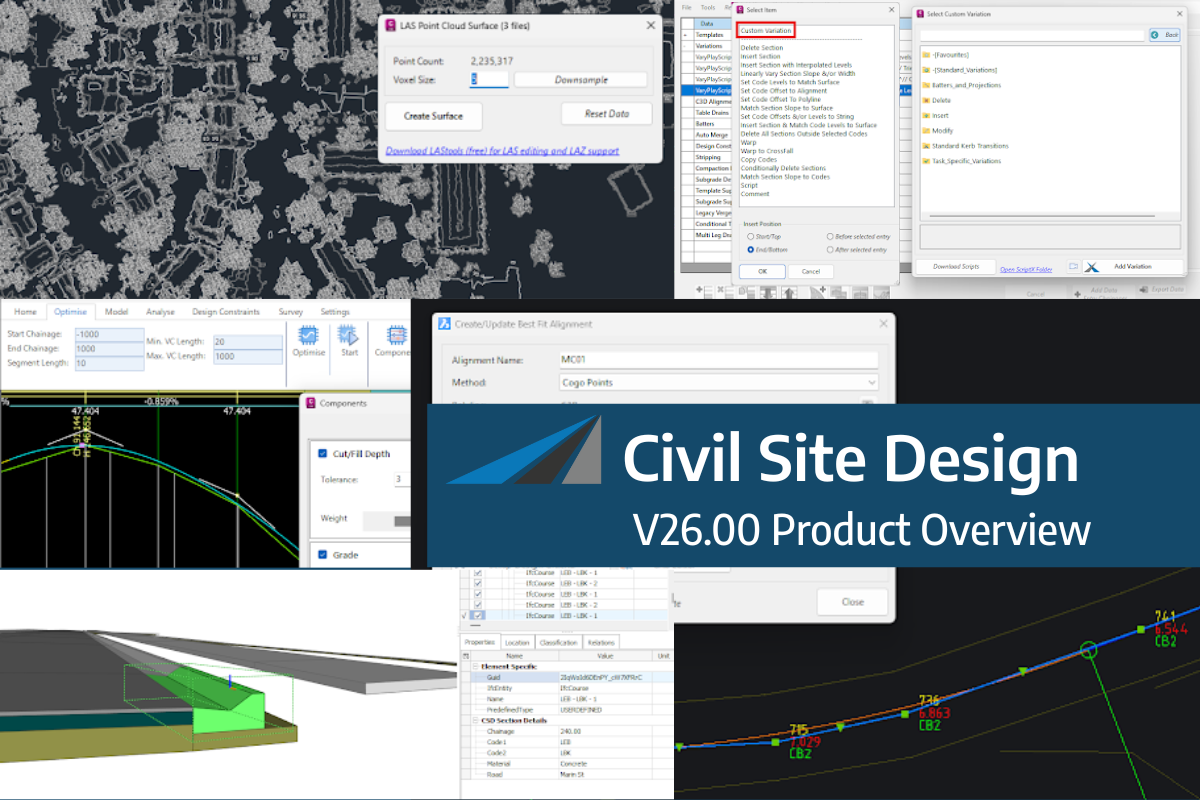
One of the exciting new features in the Civil Site Design V26 and Stringer Topo V26 release is the Surface from LAS command. Often LiDAR and point cloud data is saved as a LAS file, which previously required interpreting in another software prior to being imported to create a surface. This new command allows you […]