Viewing height or terrain data on your Civil Site Design & Civil 3D surfaces, is now possible with the new Surface Analysis in Model Viewer.
Found in Toggle Display, users can create quick and simple terrain colouring to view height ranges on surfaces, including design surfaces and models. Using the same technology, Road String slope and crossfall analysis can also be applied to the design.
Found in Model Viewer, the new Catchment Analysis tool has been developed to help users review surface and model data to analyse potential Ponding, Catchment areas and Low Points. With this new technology users are able to quickly assess surfaces and models within the project and determine if surface flows will meet the design requirements.
Model Viewer – Surface Analysis
Model Viewer – Catchment Analysis
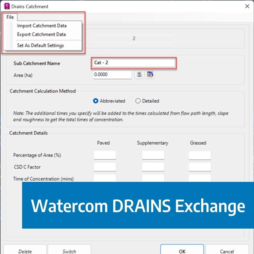
The DRAINS exchange for Civil Site Design has been established for over 10 years and has provided users with a solution of drafting in the CAD environment, analysing in DRAINS and generating design long sections with the HGL in Civil Site Design. This popular functionality has been a staple for drainage engineers looking to speed up the process of designing and drafting between the applications.

Our friends at Watercom are having their best-ever EOFY Sale! Get up to 50% off new DRAINS licences, subscriptions, upgrades, Online Training & and In-Person Workshops! Licensing & Subscriptions 30% off new DRAINS Subscriptions 30% off new DRAINS USB Licences Up to 50% off upgrading existing USB Licences View Licensing Deals Training 50% off On-Demand […]

We are pleased to announce that a sister company to Civil Survey Solutions Pty Ltd has been formed called ‘Civil Survey Applications Pty Ltd’ to take the development and marketing of the Civil Site Design and Stringer Topo software to the next level.

With the release of V24 has come a number of new and improved features. Join us as we explore the major functionality update, Toolspace, which has been developed to enhance the user experience for operators at all levels.