Non-linear design is when a typical, cross section-based design does not generate the intended result. Typically for designs that are non-parallel, such as driveways, car parks, commercial / Industrial, residential & retaining wall projects. In this webinar, our expert, Jonathan Taylor will show you how to use the Civil Site Design tools to tackle these types of projects. Exploring Grading Strings and surface based design, including staple tools such as Insert Sections, Surface Extend, Design Constraints and Model Builder. Stick around towards the end where you can see how to use the Driveway Checker to review the proposed crossing.
0:00 Introduction & Overview
6:47 Kerb Reconstruction & Drive Crossing
10:40 Surface Extend
14:50 Paste Surface
16:10 Connecting the Road CL
18:42 Designing the edge codes strings
23:32 Transitioning with Design Constraints
31:58 Threads
33:14 Design Variation – Match to Strings
37:35 Model Builder
42:00 Matching Non-Linear Strings
43:30 Surface Extend
45:46 Edge 1 – Auto Profile
48:02 Inserting Grading String Sections
50:30 Edge 2 – Auto Profile
53:34 Parking Island
56:59 CAD Objects with Model Builder
59:30 Driveway Checking Proposed Designs
1:01:46 Grading Strings vs Profile Strings
1:03:45 Grading String Subgrade

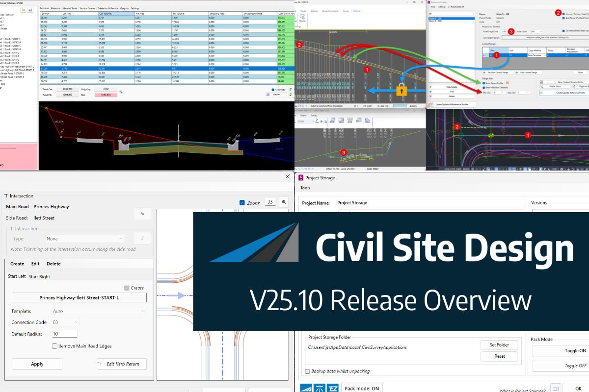
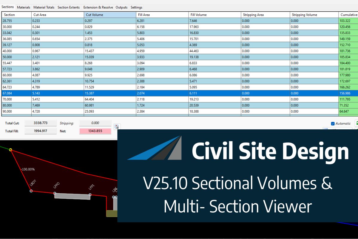
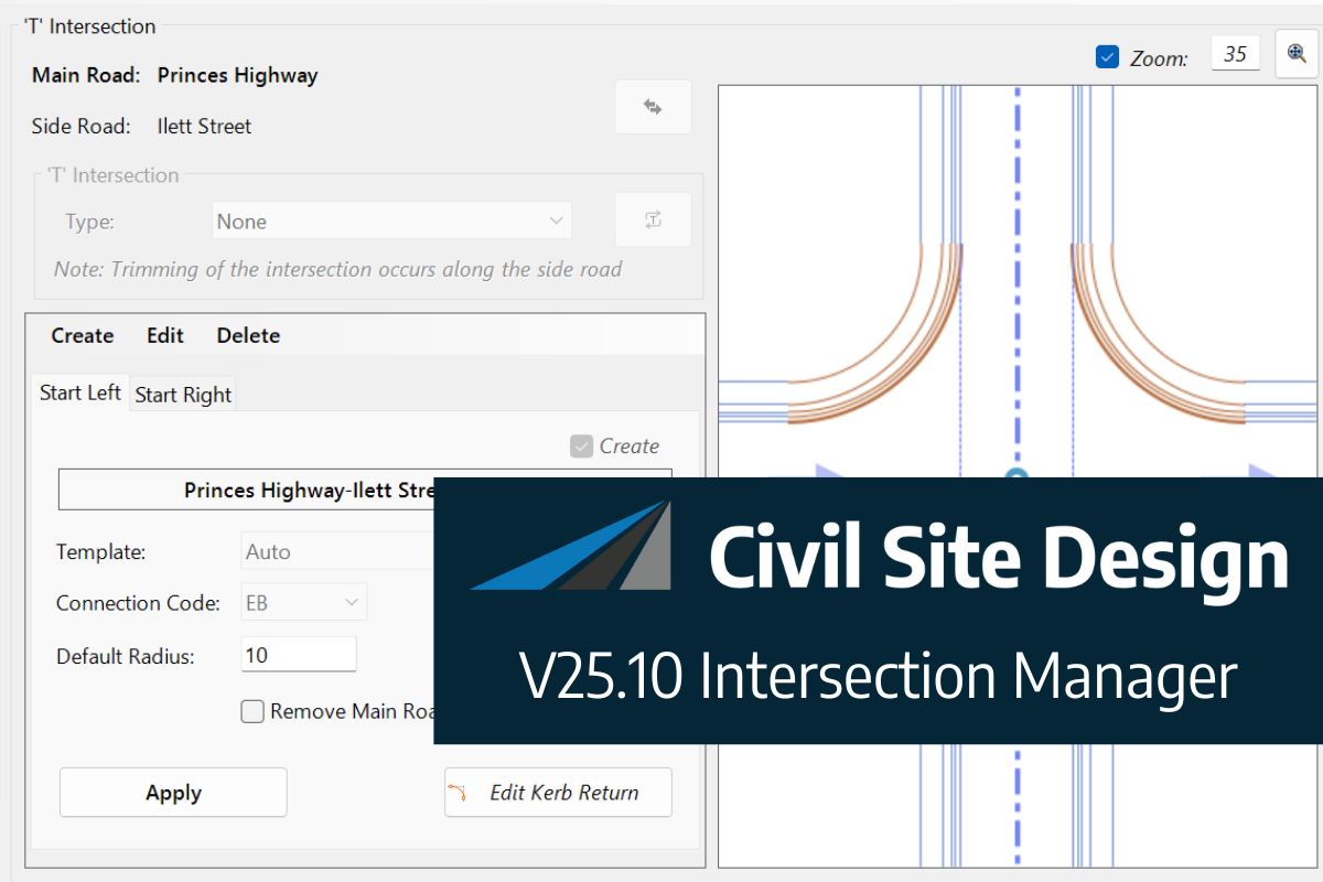
In this webinar, join our experts, Todd Brewster and Jonathan Taylor as they unpack some of the major updates within Civil Site Design V25.10. 0:00 Introduction 5:08 Project Storage 24:48 Intersection Manager 36:50 Sectional Volumes & Multi Viewer 54:16 Reference Profiles 1:12:19 Projected Profiles (Civil 3D only) Key features and improvements of Civil Site Design […]