In this webinar, join our experts, Todd Brewster and Jonathan Taylor as they unpack some of the major updates within Civil Site Design V25.10.
0:00 Introduction
5:08 Project Storage
24:48 Intersection Manager
36:50 Sectional Volumes & Multi Viewer
54:16 Reference Profiles
1:12:19 Projected Profiles (Civil 3D only)
Key features and improvements of Civil Site Design V25.10
We are pleased to unveil the latest enhancements in Civil Site Design V25.10, offering robust new tools to optimise workflows and improve precision in design tasks. Below is an overview of the key updates. Click the links to access additional in-depth technical information for each feature.
The Intersection Manager introduces comprehensive control over your intersection designs, empowering users to refine project outcomes with enhanced accuracy. Key technical enhancements include:
- Efficient identification and selection of crossing and tee intersection roads, supported with auto-zoom capability.
- Configurable intersection crowning options, including ‘all crowned’ and ‘primary crowned’ configurations.
- The ability to convert crossing road strings into tee intersections, streamlining the process of plotting or publishing long section/profile views beyond the main road centreline.
- Bulk editing capabilities, allowing:
- Deletion of all kerb returns.
- Modification of radii and overriding templates.
- Ignoring intersections (no vertical match or kerb returns) and preventing kerb return creation as required.
Click here to read more about Intersection Manager.
Reference Profiles enhance the vertical design of kerb lines by dynamically linking them to the road centreline. Key technical advantages include:
- Customisable chainage ranges for editing of the kerb lines to introduce crossfall transitions and compliance with longitudinal grade design standards.
- Automated creation for Reference Profiles and applying edits to the Road cross sections, ensuring consistent transitions on both left and right sides through intersections.
- Click button inclusion of Reference Profiles as Civil 3D profiles projected onto your road Profile Views (Civil 3D only) for plan production outputs.
This feature is particularly advantageous for jurisdictions requiring kerb line representation as Civil 3D profiles added to or instead of road centrelines.
Click here to read more about Reference Profiles.
Projected Profiles address the challenge of integrating independently designed road features, such as parking bays or knuckles, into main road profile views. Key functionality includes:
- Preservation of design IPs (PVIs) and vertical curves, enabling efficient and relevant profile view labels.
- Projection of fully designed profiles onto main road alignments, with options to retain or reproject vertical curve lengths from the source string.
Click here to read more about Projected Profiles.
The upgraded Sectional Volumes Tool delivers advanced functionality for earthworks volume assessment. Enhancements include:
- A refined interface with expanded output options, such as polylines, surfaces, Excel exports, and CAD tables.
- Graphical display enabling visual review and evaluation of cut/fill areas per section
- Refined cut/fill area calculation method and control over the section sampling for more accurate volume results
- Customisable cut/fill calculations, including clipping to specific section extents and adjustable datums for cut volume computations.
Click here to read more about the Sectional Volume Tool.
The Multi Viewer consolidates sectional data into a unified interface, providing:
- Integrated visualisation of cut/fill areas and volume tables.
- Export capabilities for documentation in CAD drawing (.dwg) files.
Click here to read more about the Multi Viewer within the Sectional Volume Tool article.
Project Storage enhances performance and facilitates cloud integration by:
- Storing operational data locally while securely packaging project data within a single drawing file.
- Streamlining project initiation through renamed and improved Pack Data Settings.
Click here to read more about Project Storage.
Civil Site Design/Corridor EZ V26 introduces support for IFC 4.3 export, giving users a powerful new way to share detailed 3D models with full classification and geometry data. This enhancement allows designers to export corridor models, road elements, and subgrade components as fully structured, BIM-ready files compatible with a wide range of IFC viewers […]
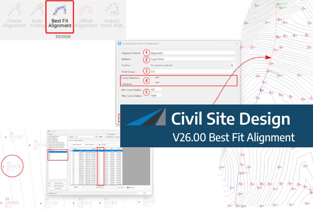
A new feature of Civil Site Design V26 is the Best Fit Alignment command. This command is available to AutoCAD and BricsCAD users and allows you to create an alignment based on Cogo Point or polyline data. When the command is run, the Best Fit algorithm analyses the Cogo Points in the specified Point […]
One of the exciting new features in the Civil Site Design V26 and Stringer Topo V26 release is the Surface from LAS command. Often LiDAR and point cloud data is saved as a LAS file, which previously required interpreting in another software prior to being imported to create a surface. This new command allows you […]


