A major part of your design process is to identify low points and to either redesign to move/remove them or to include stormwater infrastructure to capture and redirect the flows. Previously you have relied upon the contour data, adding water drops and reviewing your vertical design and cross sections to determine low point locations.
Now, you can create CSA COGO points at both high and low points by picking a surface model for your design and also picking the Code/s to analyse for high/low points. These are COGO points, so you can name them, include them in Point Groups, use them to create a surface, as a reference for adding structures and export them to file.
Access and Operation
You’ll find this new tool in the Roads Ribbon tab as well as in the CSD Toolspace (right click on Models).

You select the Model to add high/low points on and the Code/s to analyse. For the output, you set up the COGO point code and display style.
Before you hit the Process button, use the tick boxes to decide whether to add COGO points at the low points, high points or both.
The software ‘walks’ along each of Code you have selected, extracts elevations at each sampled section, and determines the low point/s. The Tolerance setting can be used to minimise low point detection when elevation differences are small between sections.
Once you press the Process button the COGO Points are created:

You can check at a glance whether there are low points where you don’t expect, including low points in kerb returns you may wish to review.
Recalculating Positions
If you make design changes and wish to review the high/low point positions, delete the points and recreate. You can delete them directly from the drawing, or we’ve added a Point Groups button on the form to open to the list of created CSA COGO points – you can highlight all in there, then click on the Options button, then Delete.
Note to Civil 3D Users
These COGO points are managed directly by Stringer/Civil Site Design – they are not Civil 3D COGO points. If you want to play around with how they look, to export them or to mass delete them, we recommend restarting this command and clicking on the Point Group button to manage them from there.
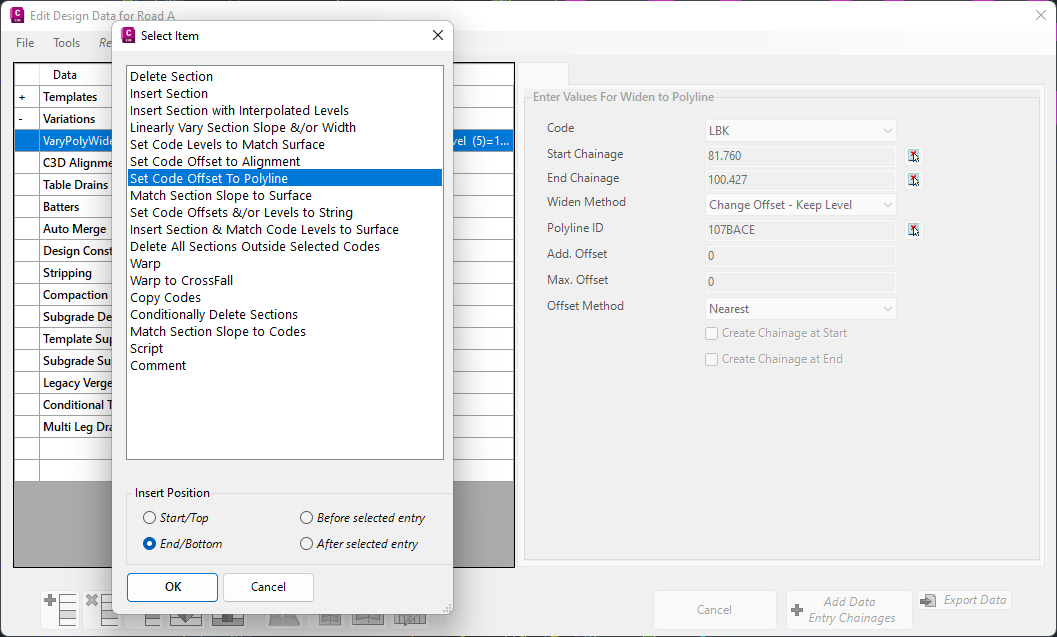
In Civil Site Design V24.10, the Design Data Form has undergone some ergonomic improvements and seen the addition of a new Design Variation – Offset by Polyline.
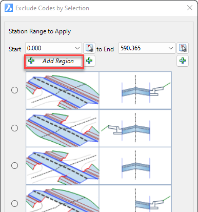
In Civil Site Design V24.10, the Model Builder Edit/Trim by Selection & Group forms received an update which can have a significant impact on selecting sections for trimming models.
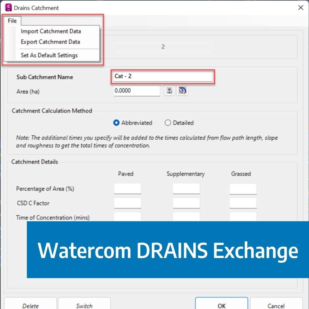
The DRAINS exchange for Civil Site Design has been established for over 10 years and has provided users with a solution of drafting in the CAD environment, analysing in DRAINS and generating design long sections with the HGL in Civil Site Design. This popular functionality has been a staple for drainage engineers looking to speed up the process of designing and drafting between the applications.

Our friends at Watercom are having their best-ever EOFY Sale! Get up to 50% off new DRAINS licences, subscriptions, upgrades, Online Training & and In-Person Workshops! Licensing & Subscriptions 30% off new DRAINS Subscriptions 30% off new DRAINS USB Licences Up to 50% off upgrading existing USB Licences View Licensing Deals Training 50% off On-Demand […]