Projected Profiles | Introduction
Created for Civil 3D production output, the Projected Profiles command addresses the challenge of integrating independently designed road features, such as parking bays or knuckles, into main road Civil 3D Profile Views.

The Projected Profiles command provides users with the ability to project String designs onto the alignment of other Strings to create Civil 3D Profiles (projecting design Civil 3D Profiles onto another alignment). Unlike Civil 3D Superimpose Profiles, the Projected Profiles command projects the design IP’s onto the selected string, then added the vertical curves.
This vastly improves the labelling of the projected Civil 3D profile, by detailing the grade and vertical curve information rather than a tessellated approximation.
Common applications of this would be for designs where it is required to show the design profile for kerb returns that connect to a road, or there is an independent vertical design for the left and right side of the road that needs to be shown along with the design centreline on the same Profile View.
Key Features and Applications:
- Profile Creation Flexibility: Supports independent vertical designs, such as kerb returns or profiles for road sides, shown alongside the design centreline in the same Profile View.
- Vertical Curve Management: Handles parabolic vertical curves, with options to transfer or project curve geometry points.
- Profile Customization: Users can select styles and labels for immediate customization.

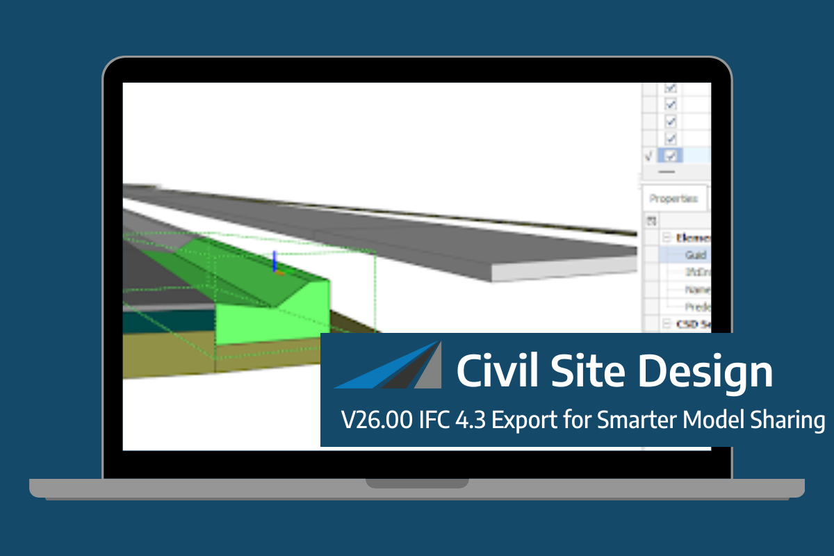
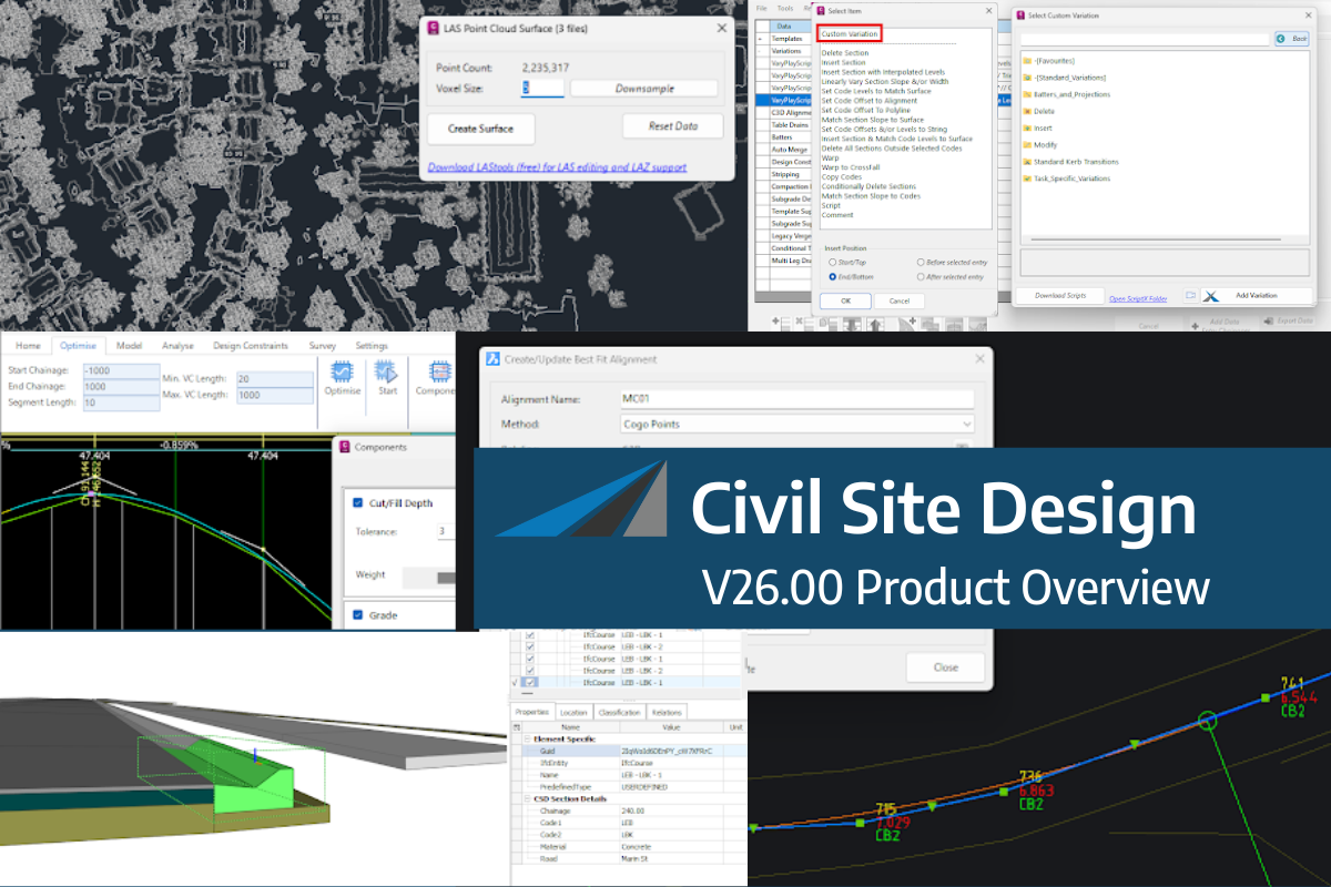
Civil Site Design/Corridor EZ V26 introduces support for IFC 4.3 export, giving users a powerful new way to share detailed 3D models with full classification and geometry data. This enhancement allows designers to export corridor models, road elements, and subgrade components as fully structured, BIM-ready files compatible with a wide range of IFC viewers […]
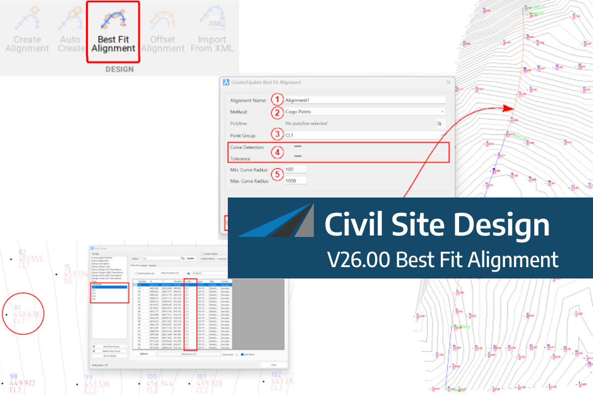
A new feature of Civil Site Design V26 is the Best Fit Alignment command. This command is available to AutoCAD and BricsCAD users and allows you to create an alignment based on Cogo Point or polyline data. When the command is run, the Best Fit algorithm analyses the Cogo Points in the specified Point […]

One of the exciting new features in the Civil Site Design V26 and Stringer Topo V26 release is the Surface from LAS command. Often LiDAR and point cloud data is saved as a LAS file, which previously required interpreting in another software prior to being imported to create a surface. This new command allows you […]