Civil Site Design V26 introduces the new command Import Cogo Point File (by Alignment). This tool allows you to import a file that specifies chainage and offset along an alignment for points to be created. The command is available for Civil Site Design and Stringer across all base platforms.
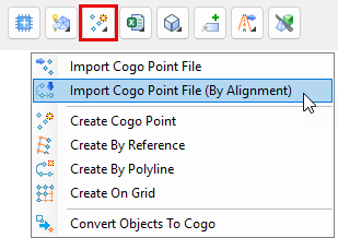
The command can be found at the bottom of the toolspace under the Cogo Points icon.
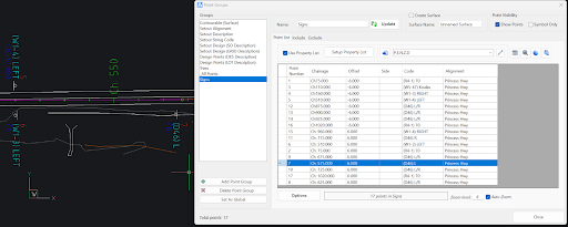
The Cogo Points by Alignment command allows you to import coordinated point files containing, at minimum, a chainage and offset input for each point you wish to create. If you are importing data using chainage and offset instead of x,y coordinates, ensure that you have applied (or created) a Point File Format to match the format of the file you are importing.
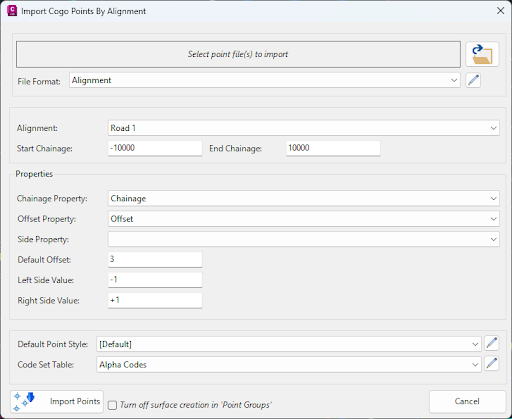
After selecting a file to import and assigning a matching file format are selected, choose the alignment in the drawing that you wish to create the points along, as well as the start and end chainage.
Next, you set properties from the file to match Chainage, Offset and (optionally) Side, so that the software knows which information in the file to apply to create the Points. If you are using positive and negative numbers to differentiate between side for offset, you can leave the Side Property box empty; however, you may have a separate entry in your file to denote ‘side’, which would need to be set as the Side Property.
Lastly, you can set the Default Point Style and Code Set Table to manage the assigned Point Style and layer for each point you will create.
Clicking Import Points will create the points as COGOPoints.