Viewing height or terrain data on your Civil Site Design & Civil 3D surfaces, is now possible with the new Surface Analysis in Model Viewer.
Found in Toggle Display, users can create quick and simple terrain colouring to view height ranges on surfaces, including design surfaces and models. Using the same technology, Road String slope and crossfall analysis can also be applied to the design.
Found in Model Viewer, the new Catchment Analysis tool has been developed to help users review surface and model data to analyse potential Ponding, Catchment areas and Low Points. With this new technology users are able to quickly assess surfaces and models within the project and determine if surface flows will meet the design requirements.
Model Viewer – Surface Analysis
Model Viewer – Catchment Analysis
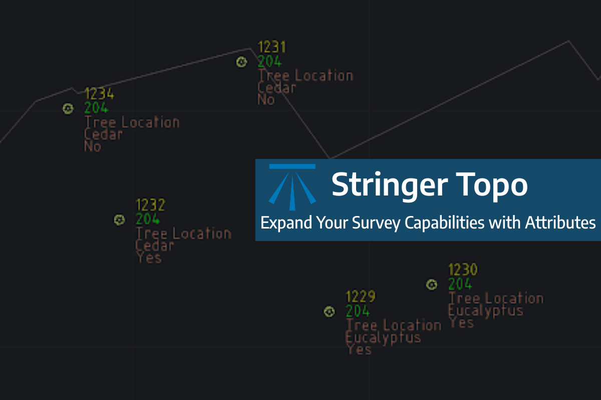
Field attributes provide Surveyors with the ability to include additional data in their Survey pickup of points. With Stringer Topo V26 users can now include additional data (attribute data) with their COGO points and survey strings for review, editing and output from their drawing. There are a number of ways to add attributes to your […]
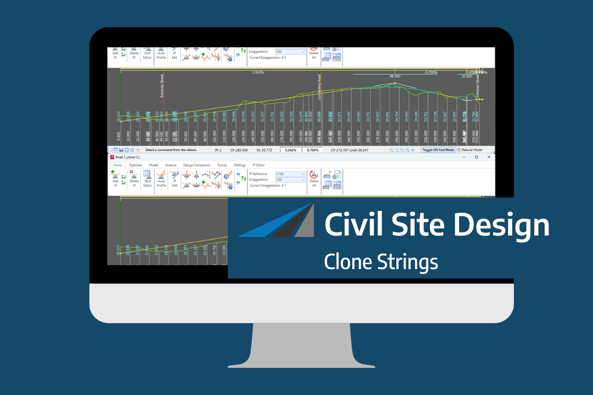
In the Civil Site Design v26 release for AutoCAD and BricsCAD, a new Clone String command has been added. This command allows users to create a clone of an existing string as a profile string including the alignment and vertical profile. This command turns what was a multi-step process into a one step process. You […]
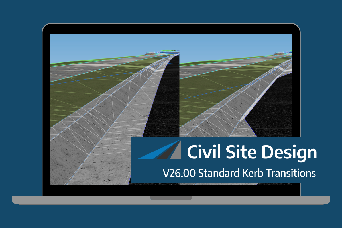
Civil Site Design/Corridor EZ v26 delivers a major upgrade to its Custom Variations functionality with the introduction of Standard Kerb Transitions. Since v25, Custom Variations have been a core feature of Civil Site Design/Corridor EZ, allowing users to apply conditional logic and geometry overrides to cross sections at specified chainages. With v26, this functionality is […]
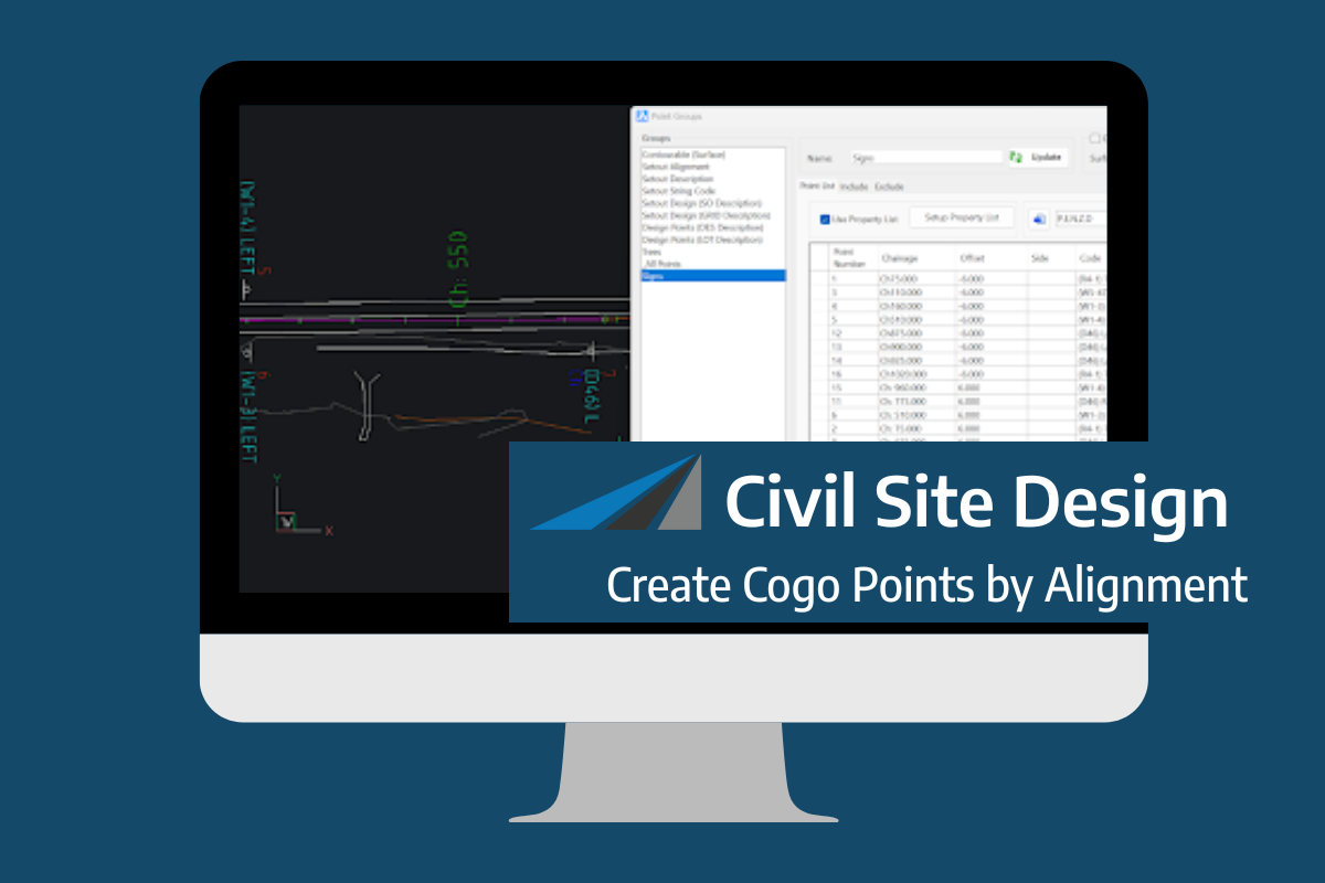
Civil Site Design V26 introduces the new command Import Cogo Point File (by Alignment). This tool allows you to import a file that specifies chainage and offset along an alignment for points to be created. The command is available for Civil Site Design and Stringer across all base platforms. The command can be found at […]