In conjunction with our partners Civil Survey Solutions, we are excited to announce the following upcoming training courses for our products Civil Site Design and Stringer Topo.
The courses are delivered by our experts and the training team at Civil Survey Solutions. As an Authorised Autodesk Training Center and Application Developer, you can trust that these courses will provide you with real-world project experience to assist your team with skills updates, project setup, application customisation and workflow consultation.
Civil Site Design
Civil Site Design | Road Reconstruction (Online – Instructor Led)
27 Feb – 1 Mar 2024 (4 Half Day Sessions)
Click here to register or learn more
Civil Site Design | Fundamentals (Online – Instructor Led)
7-8 May 2024 (2 Half Day Sessions)
Click here to register or learn more
Civil Site Design | Road Subdivision (Online – Instructor Led)
21 – 24 May 2024 (4 Half Day Sessions)
Click here to register or learn more
Civil Site Design | Pipes (Online – Instructor Led)
11-14 June 2024 (4 Half Day Sessions)
Click here to register or learn more
Stringer Topo
Stringer Topo | For CAD Platforms (Online – Instructor Led)
4-7 June 2024 (4 Half Day Sessions)
Click here to register or learn more
Stringer Topo | For Civil 3D (Online – Instructor Led)
25-28 June 2024 (4 Half Day Sessions)
Click here to register or learn more
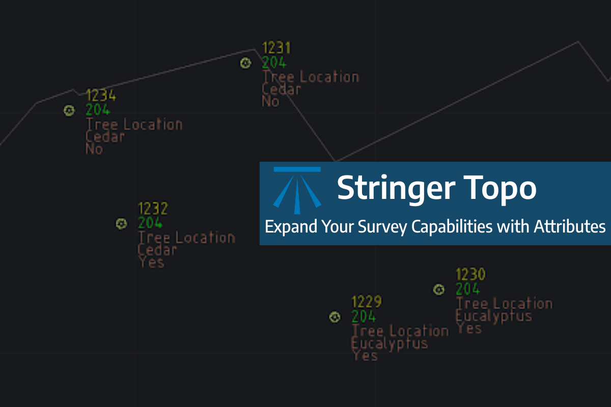
Field attributes provide Surveyors with the ability to include additional data in their Survey pickup of points. With Stringer Topo V26 users can now include additional data (attribute data) with their COGO points and survey strings for review, editing and output from their drawing. There are a number of ways to add attributes to your […]
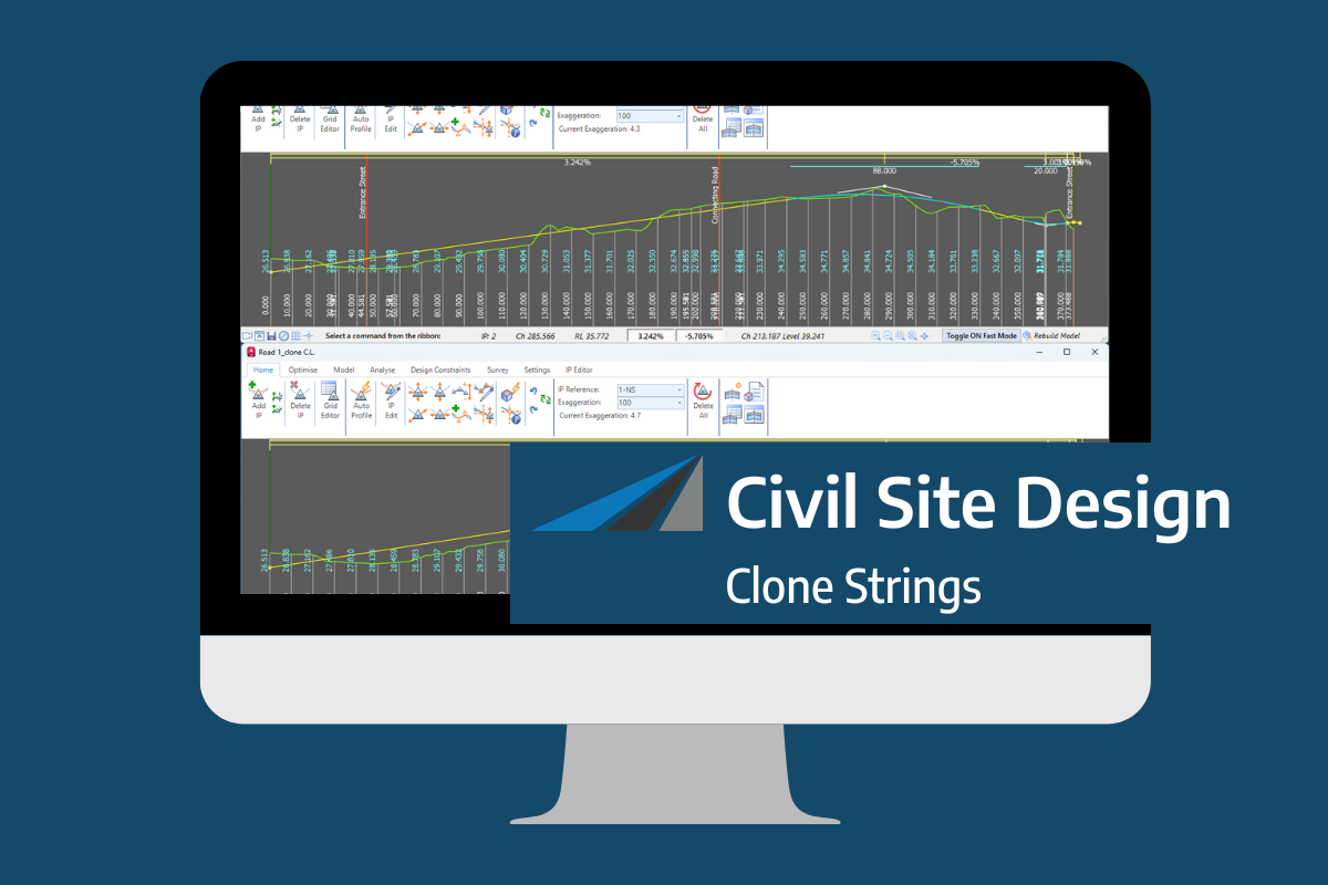
In the Civil Site Design v26 release for AutoCAD and BricsCAD, a new Clone String command has been added. This command allows users to create a clone of an existing string as a profile string including the alignment and vertical profile. This command turns what was a multi-step process into a one step process. You […]
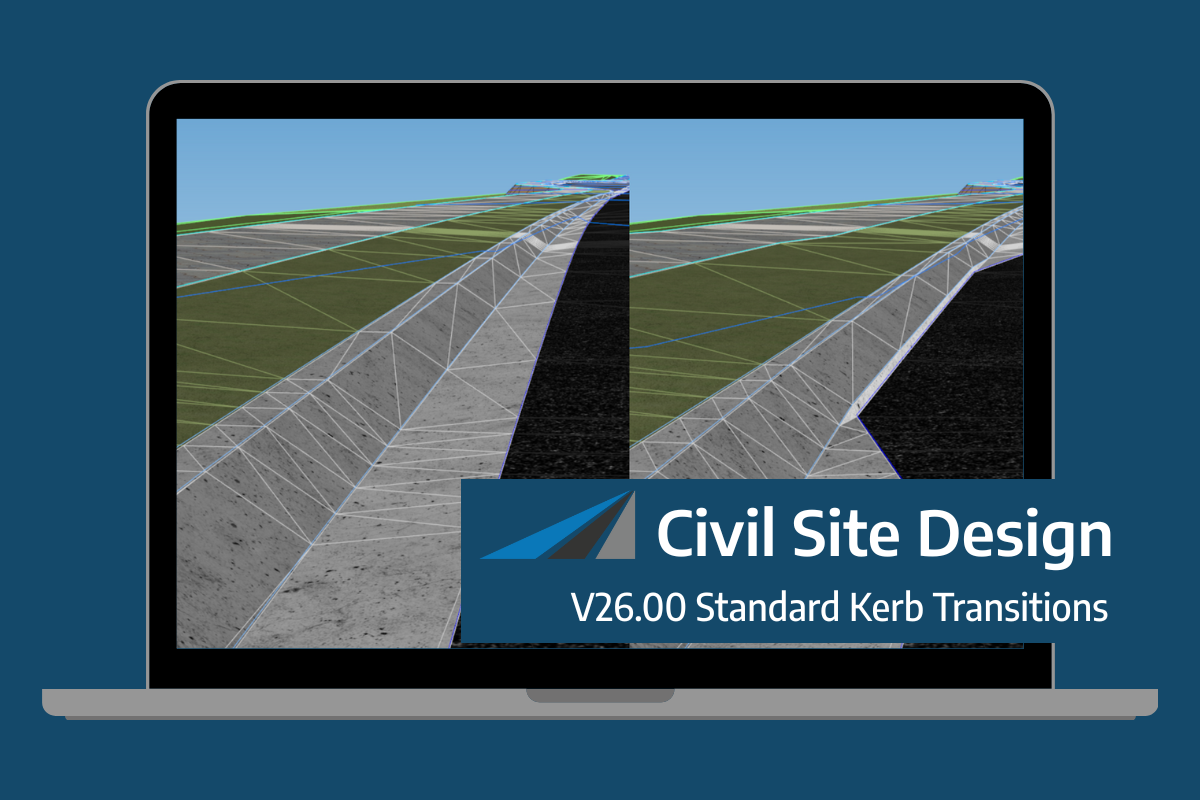
Civil Site Design/Corridor EZ v26 delivers a major upgrade to its Custom Variations functionality with the introduction of Standard Kerb Transitions. Since v25, Custom Variations have been a core feature of Civil Site Design/Corridor EZ, allowing users to apply conditional logic and geometry overrides to cross sections at specified chainages. With v26, this functionality is […]
